 https://spatialvision.com.au/wp-content/uploads/2024/07/complexity-to-clarity-blog-image.jpg
503
900
Samantha Sinclair
https://spatialvision.com.au/wp-content/uploads/2020/04/SV_Logo_Inline.png
Samantha Sinclair2024-07-24 17:14:062024-07-24 17:39:25Navigating the complexity of geoscience data analysis
https://spatialvision.com.au/wp-content/uploads/2024/07/complexity-to-clarity-blog-image.jpg
503
900
Samantha Sinclair
https://spatialvision.com.au/wp-content/uploads/2020/04/SV_Logo_Inline.png
Samantha Sinclair2024-07-24 17:14:062024-07-24 17:39:25Navigating the complexity of geoscience data analysisData Visualisation
Using the latest geospatial and cloud technologies, we provide interactive web resources to improve organisational and community engagement and utilisation. Our data visualisation skills encompass a variety of technologies including Open Source and proprietary products including ArcGIS Online, Carto and Leaflet.
Our tools unlock the value of corporate data to aid decision-making and deliver meaningful information to your stakeholders.
We help you source, collate and enhance what can be disparate data sets, and present them in a manner that provides insight and clarity to tell compelling stories and support your mission.

CASE STUDIES AND NEWS
https://spatialvision.com.au/wp-content/uploads/2024/07/complexity-to-clarity-blog-image.jpg
503
900
Samantha Sinclair
https://spatialvision.com.au/wp-content/uploads/2020/04/SV_Logo_Inline.png
Samantha Sinclair2024-07-24 17:14:062024-07-24 17:39:25Navigating the complexity of geoscience data analysis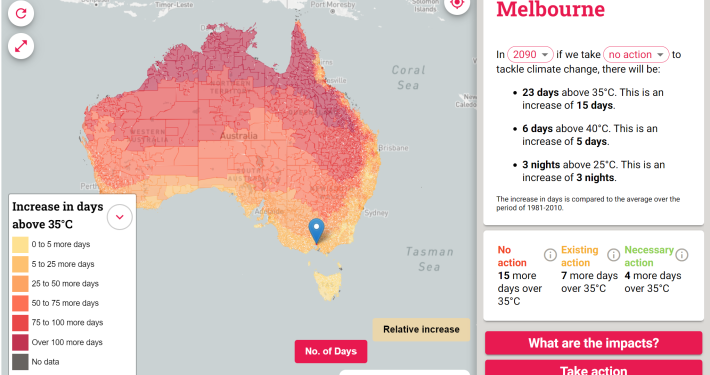 https://spatialvision.com.au/wp-content/uploads/2024/02/Heat-map-Aust.png
1404
2043
Samantha Sinclair
https://spatialvision.com.au/wp-content/uploads/2020/04/SV_Logo_Inline.png
Samantha Sinclair2024-02-28 11:19:072024-03-15 13:19:14Hot enough for you? Climate Heat Map of Australia released
https://spatialvision.com.au/wp-content/uploads/2024/02/Heat-map-Aust.png
1404
2043
Samantha Sinclair
https://spatialvision.com.au/wp-content/uploads/2020/04/SV_Logo_Inline.png
Samantha Sinclair2024-02-28 11:19:072024-03-15 13:19:14Hot enough for you? Climate Heat Map of Australia released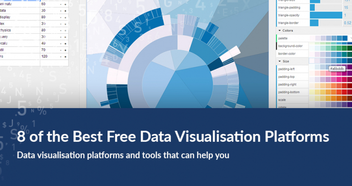 https://spatialvision.com.au/wp-content/uploads/2018/03/8-of-the-Best-Data-Visualisation-Platforms.jpg
506
900
Spatial Vision
https://spatialvision.com.au/wp-content/uploads/2020/04/SV_Logo_Inline.png
Spatial Vision2021-05-13 08:11:502023-12-20 12:06:008 of the Best Data Visualisation Platforms
https://spatialvision.com.au/wp-content/uploads/2018/03/8-of-the-Best-Data-Visualisation-Platforms.jpg
506
900
Spatial Vision
https://spatialvision.com.au/wp-content/uploads/2020/04/SV_Logo_Inline.png
Spatial Vision2021-05-13 08:11:502023-12-20 12:06:008 of the Best Data Visualisation Platforms https://spatialvision.com.au/wp-content/uploads/2020/04/Case-Study-cover.png
500
900
Spatial Vision
https://spatialvision.com.au/wp-content/uploads/2020/04/SV_Logo_Inline.png
Spatial Vision2020-04-30 22:01:012023-12-20 12:11:54Case Study: 1800 My Options
https://spatialvision.com.au/wp-content/uploads/2020/04/Case-Study-cover.png
500
900
Spatial Vision
https://spatialvision.com.au/wp-content/uploads/2020/04/SV_Logo_Inline.png
Spatial Vision2020-04-30 22:01:012023-12-20 12:11:54Case Study: 1800 My Options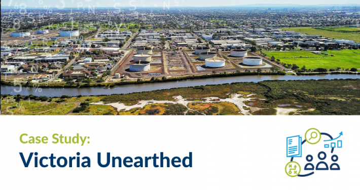 https://spatialvision.com.au/wp-content/uploads/2019/10/Case-Study-cover-2.png
500
900
Spatial Vision
https://spatialvision.com.au/wp-content/uploads/2020/04/SV_Logo_Inline.png
Spatial Vision2019-11-19 08:55:582023-12-20 12:13:29Case Study: Victoria Unearthed
https://spatialvision.com.au/wp-content/uploads/2019/10/Case-Study-cover-2.png
500
900
Spatial Vision
https://spatialvision.com.au/wp-content/uploads/2020/04/SV_Logo_Inline.png
Spatial Vision2019-11-19 08:55:582023-12-20 12:13:29Case Study: Victoria Unearthed https://spatialvision.com.au/wp-content/uploads/2019/08/Case-Study-cover.png
500
900
Spatial Vision
https://spatialvision.com.au/wp-content/uploads/2020/04/SV_Logo_Inline.png
Spatial Vision2019-08-02 17:16:352023-12-20 12:15:30Case Study: Embedding Climate Adaptation in Agriculture in North East Victoria
https://spatialvision.com.au/wp-content/uploads/2019/08/Case-Study-cover.png
500
900
Spatial Vision
https://spatialvision.com.au/wp-content/uploads/2020/04/SV_Logo_Inline.png
Spatial Vision2019-08-02 17:16:352023-12-20 12:15:30Case Study: Embedding Climate Adaptation in Agriculture in North East Victoria https://spatialvision.com.au/wp-content/uploads/2019/07/Case-Study-cover-01-4.png
500
900
Spatial Vision
https://spatialvision.com.au/wp-content/uploads/2020/04/SV_Logo_Inline.png
Spatial Vision2019-07-19 15:38:542023-12-20 12:15:39Case Study: Cooling the City Pilot Project
https://spatialvision.com.au/wp-content/uploads/2019/07/Case-Study-cover-01-4.png
500
900
Spatial Vision
https://spatialvision.com.au/wp-content/uploads/2020/04/SV_Logo_Inline.png
Spatial Vision2019-07-19 15:38:542023-12-20 12:15:39Case Study: Cooling the City Pilot Project https://spatialvision.com.au/wp-content/uploads/2019/07/Blog-cover-part-2.jpg
500
900
Tom Hollands
https://spatialvision.com.au/wp-content/uploads/2020/04/SV_Logo_Inline.png
Tom Hollands2019-07-12 16:04:482023-12-20 12:15:49Getting Started with Power BI Part 2
https://spatialvision.com.au/wp-content/uploads/2019/07/Blog-cover-part-2.jpg
500
900
Tom Hollands
https://spatialvision.com.au/wp-content/uploads/2020/04/SV_Logo_Inline.png
Tom Hollands2019-07-12 16:04:482023-12-20 12:15:49Getting Started with Power BI Part 2 https://spatialvision.com.au/wp-content/uploads/2019/07/Blog-cover-01-2.jpg
500
900
Tom Hollands
https://spatialvision.com.au/wp-content/uploads/2020/04/SV_Logo_Inline.png
Tom Hollands2019-07-04 16:04:302023-12-20 12:16:13Getting Started with Power BI Part 1
https://spatialvision.com.au/wp-content/uploads/2019/07/Blog-cover-01-2.jpg
500
900
Tom Hollands
https://spatialvision.com.au/wp-content/uploads/2020/04/SV_Logo_Inline.png
Tom Hollands2019-07-04 16:04:302023-12-20 12:16:13Getting Started with Power BI Part 1 https://spatialvision.com.au/wp-content/uploads/2019/06/cool-routes.png
862
1384
Spatial Vision
https://spatialvision.com.au/wp-content/uploads/2020/04/SV_Logo_Inline.png
Spatial Vision2019-06-17 10:01:072023-12-20 12:16:23Cooling the City Visualisation
https://spatialvision.com.au/wp-content/uploads/2019/06/cool-routes.png
862
1384
Spatial Vision
https://spatialvision.com.au/wp-content/uploads/2020/04/SV_Logo_Inline.png
Spatial Vision2019-06-17 10:01:072023-12-20 12:16:23Cooling the City Visualisation https://spatialvision.com.au/wp-content/uploads/2019/01/7-of-the-Best-Data-Visualisation-Platforms.png
500
900
Spatial Vision
https://spatialvision.com.au/wp-content/uploads/2020/04/SV_Logo_Inline.png
Spatial Vision2019-03-08 10:58:052023-12-20 12:17:497 of the Best Data Visualisation Platforms
https://spatialvision.com.au/wp-content/uploads/2019/01/7-of-the-Best-Data-Visualisation-Platforms.png
500
900
Spatial Vision
https://spatialvision.com.au/wp-content/uploads/2020/04/SV_Logo_Inline.png
Spatial Vision2019-03-08 10:58:052023-12-20 12:17:497 of the Best Data Visualisation Platforms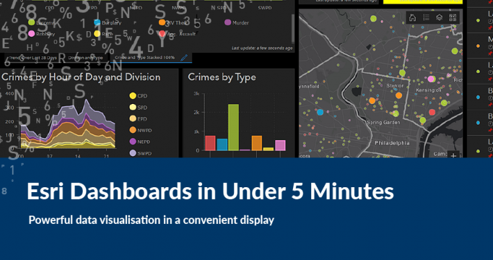 https://spatialvision.com.au/wp-content/uploads/2019/03/Dashboard-cover.png
500
900
Samantha Sinclair
https://spatialvision.com.au/wp-content/uploads/2020/04/SV_Logo_Inline.png
Samantha Sinclair2019-02-22 12:04:062023-12-20 12:18:02Esri Dashboards in Under 5 Minutes
https://spatialvision.com.au/wp-content/uploads/2019/03/Dashboard-cover.png
500
900
Samantha Sinclair
https://spatialvision.com.au/wp-content/uploads/2020/04/SV_Logo_Inline.png
Samantha Sinclair2019-02-22 12:04:062023-12-20 12:18:02Esri Dashboards in Under 5 Minutes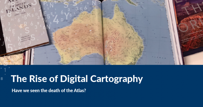 https://spatialvision.com.au/wp-content/uploads/2019/02/Atlas-Cover2.png
500
900
Spatial Vision
https://spatialvision.com.au/wp-content/uploads/2020/04/SV_Logo_Inline.png
Spatial Vision2019-02-18 00:14:292023-12-20 12:18:09Have We Seen The Death Of The Atlas?
https://spatialvision.com.au/wp-content/uploads/2019/02/Atlas-Cover2.png
500
900
Spatial Vision
https://spatialvision.com.au/wp-content/uploads/2020/04/SV_Logo_Inline.png
Spatial Vision2019-02-18 00:14:292023-12-20 12:18:09Have We Seen The Death Of The Atlas?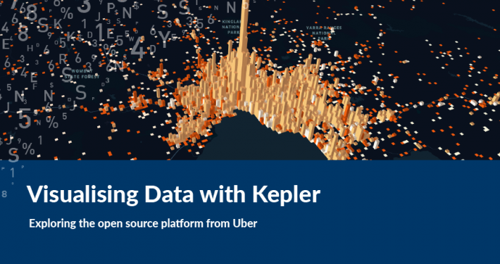 https://spatialvision.com.au/wp-content/uploads/2019/01/Visualising-Data-with-Kepler.png
500
900
Samantha Sinclair
https://spatialvision.com.au/wp-content/uploads/2020/04/SV_Logo_Inline.png
Samantha Sinclair2018-07-30 22:44:402023-12-20 12:22:58Visualising Data with Kepler
https://spatialvision.com.au/wp-content/uploads/2019/01/Visualising-Data-with-Kepler.png
500
900
Samantha Sinclair
https://spatialvision.com.au/wp-content/uploads/2020/04/SV_Logo_Inline.png
Samantha Sinclair2018-07-30 22:44:402023-12-20 12:22:58Visualising Data with Kepler https://spatialvision.com.au/wp-content/uploads/2019/02/1Artboard-1Concepts.png
500
900
Spatial Vision
https://spatialvision.com.au/wp-content/uploads/2020/04/SV_Logo_Inline.png
Spatial Vision2018-04-26 15:46:222024-07-24 13:46:45Case Study: Victorian Women’s Health Atlas
https://spatialvision.com.au/wp-content/uploads/2019/02/1Artboard-1Concepts.png
500
900
Spatial Vision
https://spatialvision.com.au/wp-content/uploads/2020/04/SV_Logo_Inline.png
Spatial Vision2018-04-26 15:46:222024-07-24 13:46:45Case Study: Victorian Women’s Health Atlas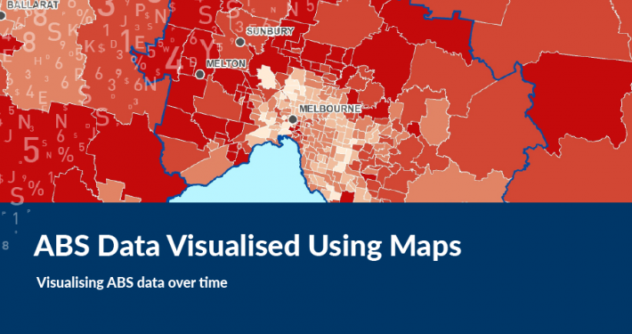 https://spatialvision.com.au/wp-content/uploads/2019/01/ABS-Data-Visualised-Using-Maps.png
500
900
Spatial Vision
https://spatialvision.com.au/wp-content/uploads/2020/04/SV_Logo_Inline.png
Spatial Vision2017-12-14 05:36:432023-12-20 12:34:10ABS Data Visualised Using Maps
https://spatialvision.com.au/wp-content/uploads/2019/01/ABS-Data-Visualised-Using-Maps.png
500
900
Spatial Vision
https://spatialvision.com.au/wp-content/uploads/2020/04/SV_Logo_Inline.png
Spatial Vision2017-12-14 05:36:432023-12-20 12:34:10ABS Data Visualised Using Maps https://spatialvision.com.au/wp-content/uploads/2019/01/Marriage-Equality-Visualisation.png
500
900
Spatial Vision
https://spatialvision.com.au/wp-content/uploads/2020/04/SV_Logo_Inline.png
Spatial Vision2017-11-29 05:32:052023-12-20 13:46:49Marriage Equality Visualisation
https://spatialvision.com.au/wp-content/uploads/2019/01/Marriage-Equality-Visualisation.png
500
900
Spatial Vision
https://spatialvision.com.au/wp-content/uploads/2020/04/SV_Logo_Inline.png
Spatial Vision2017-11-29 05:32:052023-12-20 13:46:49Marriage Equality Visualisation https://spatialvision.com.au/wp-content/uploads/2019/02/EMET-Cover.png
500
900
Spatial Vision
https://spatialvision.com.au/wp-content/uploads/2020/04/SV_Logo_Inline.png
Spatial Vision2017-05-12 13:50:472023-12-20 14:45:04Case Study: EMET Web Map
https://spatialvision.com.au/wp-content/uploads/2019/02/EMET-Cover.png
500
900
Spatial Vision
https://spatialvision.com.au/wp-content/uploads/2020/04/SV_Logo_Inline.png
Spatial Vision2017-05-12 13:50:472023-12-20 14:45:04Case Study: EMET Web Map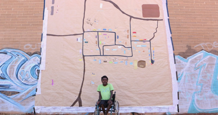 https://spatialvision.com.au/wp-content/uploads/2019/01/dion.jpg
601
900
Spatial Vision
https://spatialvision.com.au/wp-content/uploads/2020/04/SV_Logo_Inline.png
Spatial Vision2015-06-09 16:21:232023-12-20 15:00:01Digital Mapping an exhibition by Dion Beasley & Media Mob
https://spatialvision.com.au/wp-content/uploads/2019/01/dion.jpg
601
900
Spatial Vision
https://spatialvision.com.au/wp-content/uploads/2020/04/SV_Logo_Inline.png
Spatial Vision2015-06-09 16:21:232023-12-20 15:00:01Digital Mapping an exhibition by Dion Beasley & Media Mob
“Well we couldn’t have done it on our own, that’s for sure. Their technical expertise shone in terms of skills and knowledge of tools, but they also gave us the in-house skills manage and update the map in the future.”
More Spatial Services areas
Link to: Spatial Solution Development

Spatial Solution Development
Link to: Spatial Analysis & Mapping
Spatial Analysis & Mapping
LATEST NEWS
 Getting the most out of your GIS strategy & investmentJuly 24, 2024 - 7:10 pm
 Climate Change & Homelessness: Understanding the ConnectionJuly 24, 2024 - 6:36 pm
 Navigating the complexity of geoscience data analysisJuly 24, 2024 - 5:14 pm
 Meet Jarryd Hunter Manager of Enterprise Spatial SolutionsJuly 24, 2024 - 1:54 pm
FOLLOW US
![]()
![]()
![]()