Cooling the City Visualisation
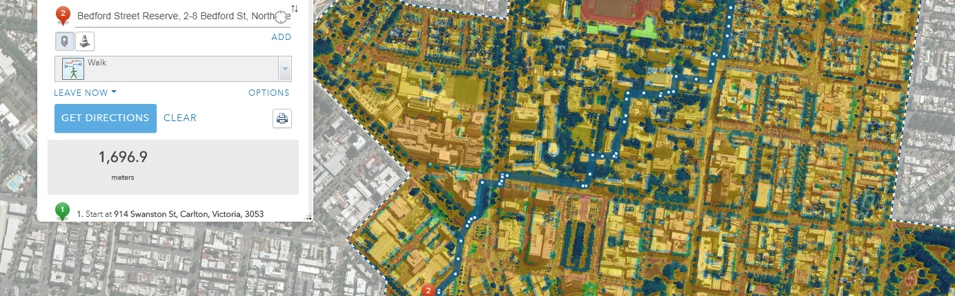
With the frequency of extreme heat events increasing in urban areas, heat stress is becoming a major health concern for pedestrians as they navigate their way across the urban landscape.This is of particular concern to the elderly and children as they are at higher risk to heat stress. While trees and shade can offer some reduction of ambient temperate, additional cooling potential depends on the nature of the surrounding urban environment, such as surface materials, geometry, building height and density.
To improve liveability and pedestrian wellbeing, the City of Melbourne is implementing a Digital Urban Infrastructure program which encompasses three pilot projects to test the performance of digital infrastructure such as sensors within the urban environment. The city is interested in further understanding the benefits, impacts, challenges and opportunities for expanding digital urban infrastructure within the municipality. Cooling the City forms one of the selected projects and involves analysing and mapping the thermal comfort for pedestrian routes.
Using a variety of key spatial datasets, including tree canopy cover, shadow cover at time of day and road and footpath surface material, held by the City of Melbourne, Spatial Vision produced a thermal comfort model that highlights the cooler routes for pedestrians as well as indicating areas of opportunity for future city planning.
The map and the results were showcased as part of Melbourne Knowledge Week in May 2019.
The findings focused on the City’s Innovation District encompassing the areas of CBD North, Carlton and Parkville.
For more information, please get in touch