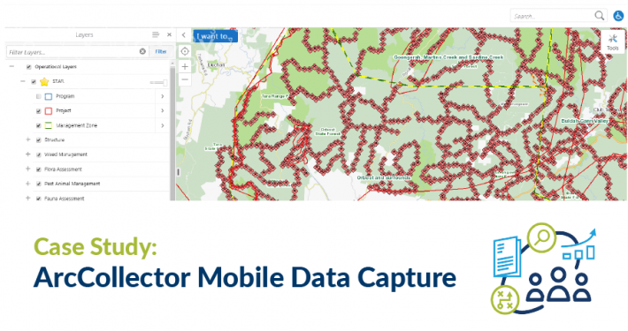
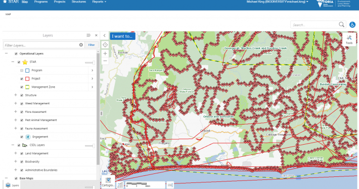
The Spatial Temporal Activity Recorder (STAR) is a plant and animal management tool for planning and delivering and recording spatial features associated with assessing and controlling plants and animals, most often weeds and pests.
The key objective of this project was to bring mobile data capture into the existing STAR solution to give field officers an easier and more consistent technique for loading their field data into STAR. An important aspect of this work was the consultation with all relevant groups to standardise data capture across the state, streamlining the condition of the environmental reporting. The solution delivered centralised access and automatic data uploading, reducing the time and cost to officers while increasing data reliability and security.