Vicmap Goes Digital
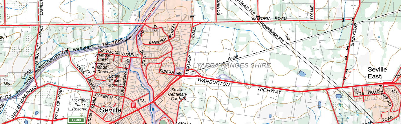
Vicmap Topographic Maps are the suite of authoritative digital and hardcopy mapping products covering the state of Victoria. They are used for a variety of purposes including emergency response management, navigation, land surveying, natural and constructed resource management, hiking, recreation, military exercises and educational use. Georeferenced PDFs can be accessed online through a link on the DELWP MapShare website, either to print at home or order in hardcopy.
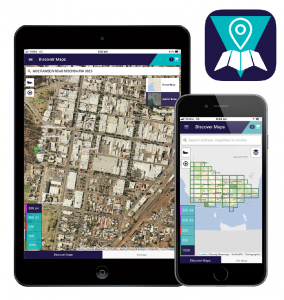
DELWP and its customers have evolved the need to access Vicmap Topographic Maps directly from portable mobile devices such as smartphones or tablets, utilising existing DELWP IT infrastructure. Spatial Vision therefore developed a mobile map app using a solution based on an advanced HTML5 hybrid framework that focuses on performance. Spatial Vision is able to create apps for multiple platforms such as iOS and Android as well as desktops using a single source code that can reduce the cost and effort of development for these multiple platforms.
Using cloud authentication services, a cost effective and highly flexible user identity management was implemented, optionally with social media logins (e.g. via Facebook, Twitter or Google accounts). Users can browse Vicmap Topographic Maps across all map scales, as well as search for specific maps according to their location.
The solution included a shopping cart, in-line with the modern and widely used online shopping experience. On checkout, where they can still modify the shopping list, they can pay for their order. The mobile payment option is integrated with an ecommerce platform to provide a seamless in-app purchase experience for the user.
Users can view their purchased maps on the Vicmap Viewer mobile app whether online or offline, and are also able to open them in any geo-referenced map viewing application such as Avenza.
Benefits
- The latest state-wide collection of over 10,000 richly detailed topographic maps based on authoritative government data made quickly accessible
- Allows emergency services, surveyors or recreationalists the ability to access the latest Vicmap Topographic Maps on demand via mobile device when responding to demanding situations in the field
- Maps downloaded through the app are georeferenced and interoperable with other mobile applications, proving useful when needing to establish orientation
- Purchased maps are available for viewing when offline in remote areas – no internet connection needed
- Search and find maps by user geolocation, mapsheet name, mapsheet number, locality or address
- Ease of registration with the ability to sign up via social media accounts
- Registered accounts and purchased maps are synchronized between various devices
- Easily downloaded from iTunes or Google Play store for free
To learn more, visit Vicmap Viewer or download the app on iTunes or Google Play.
For more information, please get in touch