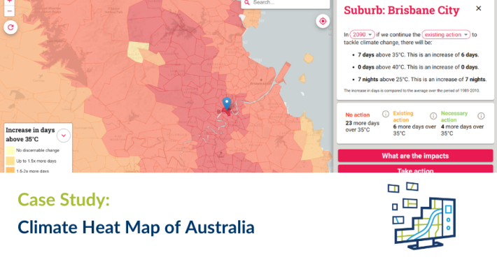
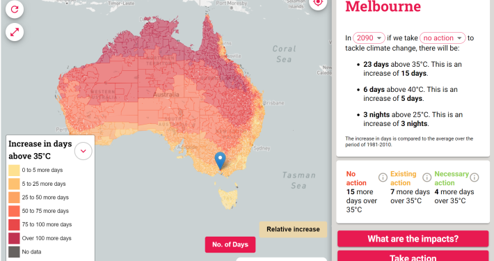
Spatial Vision developed an interactive map of Australia for the Climate Council representing the extent of extreme heat days over different timeframes and climate action scenarios.

Whilst extreme heat is nothing new to most Australians, climate change is gradually increasing the frequency and impact of heatwaves. A detailed analysis by the Climate Council projects that by the end of the century Australian capital cities are set to swelter through twice as many days above 35°C.
Spatial Vision worked with the Climate Council to develop a user-friendly web application for the general public to educate and inform, as well as garner media attention for wider promotion. The goal is for Australia to wholly embrace renewable energy and phase out pollution from coal, oil and gas to help protect communities from unliveable temperatures.
App users can input their suburb or postcode into the heat map interface to see how varying climate pollution outcomes can affect the number of extreme heat occurrences in their area. Thousands of data points from CSIRO and the Bureau of Meteorology’s Climate Change in Australia project were collated to ensure the projections are based on scientific data.
The storytelling aspect of the heat map is enhanced by a feature that details various impacts around the country, such as on the food bowl, the Great Barrier Reef, vital infrastructure and rainforests. The map makes it clear that beyond the inherent health risks, extreme heat has potentially far-reaching and dire consequences on people’s work, the liveability of certain locations and the nation’s economy.
")