I recently had the pleasure of attending the Geocart 2018 conference held in Wellington, New Zealand. Geocart is a bi-annual conference jointly organized by the New Zealand Cartographic Society and the Australian & New Zealand Map Society (ANZmaps).
Held over three days, the conference ran two streams of presentations and six keynote talks about many broad cartographic related topics. Themes such as Marine Cartography, Mapping Space and Time, Art and Critical Cartography and many others were explored. What I found most enjoyable was the breadth of subject matter available and the quality of the presentations on display.
Presentation Highlights
Conference organisers clearly put a lot of thought into the groupings of presentations, which made each session fascinating and enjoyable. Presentations of note that had relevance for me were Greg Byrom’s talk on a new QGIS redistricting plug-in for electoral boundary determination; Pascal Sirguey’s presentation on ‘Moving on From a 30 year-old Legacy in Mapping the Southern Alps Topography’; Christopher Stephens and Wendy Shaw’s presentation on ‘The Evolution of the New Zealand Gazetteer’, particularly the expansion of indigenous names in the gazetteer;

Sarah Ryan’s presentation of the history and development of Birrarung (the Yarra River); Mark Brown and Bill Pascoe from the University of Newcastle and the development of their web map showing indigenous massacre sites; Geoffrey Lemarche talking about the new Seabed 2030 project of gathering bathymetric data for the globe; and Anton Thomas’ beautiful hand-drawn map of North America – over 4000 hours of work.
Awards and Keynotes
During the conference there was a Map Gallery and map awards ceremony. Spatial Vision was fortunate to garner two highly commended awards for the Jacaranda Atlas Ninth Edition and the Southern Grampians Outdoor Recreation Guide, whilst Anton Thomas’ map of North America scooped the prize for best overall product. The overall quality of entries was extremely high and congratulations must go to all who entered products into the competition.
Of the keynote presentations there were a couple of standouts: Christopher Fleet from the National Library of Scotland discussed their approach to presenting their collection of maps through the web, the types of metadata required to make searching easy and defining maps by their extents to allow others to utilize the collection through their API.

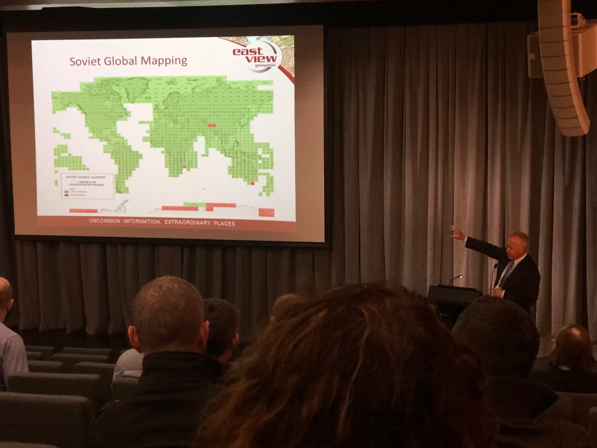
Kent Lee from East View Information Services talked about how he got access to Soviet military mapping at the end of the Cold War and how his company has built on that repository of content providing access to maps and data from all corners of the globe.
Chris McDowell provided a thoughtful keynote on ‘Looking up from the map’. Using examples of his own work he described a user-centric approach to map creation for both print and digital cartography, emphasizing the need to test and workshop your creations with users (not necessarily professionals).
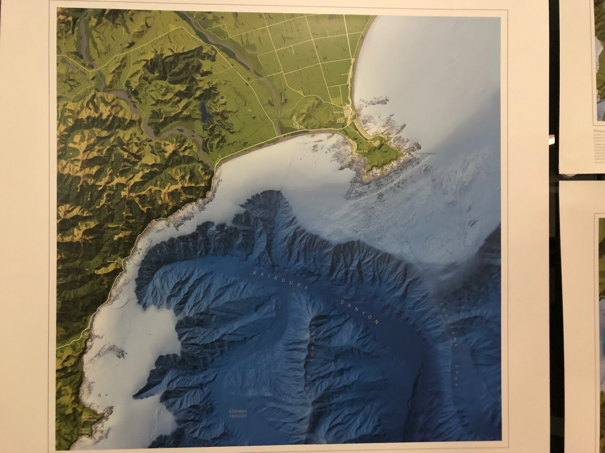
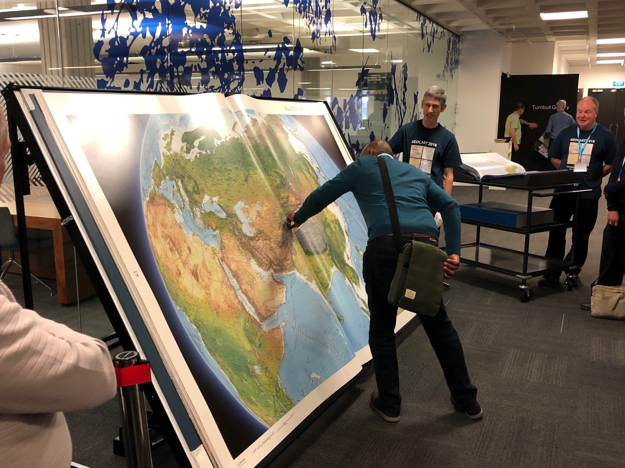
The World’s Largest Atlas
One of the purely cartographic highlights was the display of the Earth Platinum Atlas – the largest atlas in the world – at the National Library of New Zealand. Carefully displayed in a large steel frame, the atlas was published by Millennium House Australia, and used the cartographic expertise of a number of the region’s best cartographers. It is a shining light as to the work of Antipodean cartographic excellence.

Regular social events and tea breaks allowed the 120 or so conference delegates to network and get to know each other better. All in all the conference was a great success and I look forward to, and encourage others to attend, the next event in 2020.
For further information, please contact Spatial Vision at info@spatialvision.com.au
- Case Study: GIS Service Plan - July 24, 2024
- Climate Change Statement - November 9, 2021
- Welcome Ryanne Firme – Digital Cadastre Modernisation Team - May 21, 2021