
For generations, Australians have witnessed and endured the harsh realities of our landscape. From unrelenting droughts to catastrophic bushfires, the country is no stranger to extreme weather.
However, with the frequency and severity of these extreme weather events predicted to increase in the near future, it’s important now more than ever to address key questions of how we can better prepare for them and how can we learn from these events to mitigate consequences into the future.
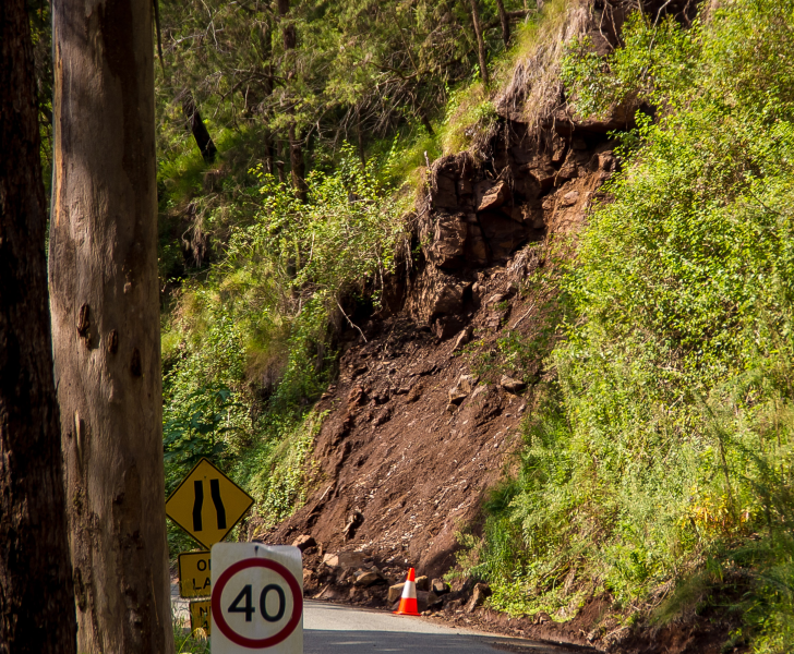
Landslides as a result of heavy rainfall a key challenge for the Colac Otway Shire in particular, with critical flow-on effects affecting communities and essential services.
Some recent work that Spatial Vision conducted, in collaboration with A. S. Miner Geotechnical, involved supporting and empowering local councils in the application of spatial data and technologies to garner a deeper understanding of risks and mitigation options of the consequential impact of climate change and associated extreme weather events on their assets and communities.
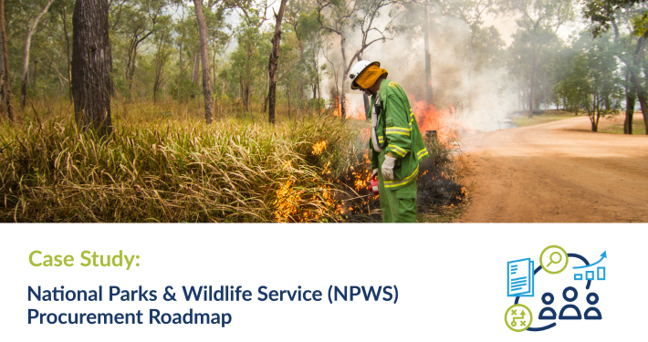
The team provided a spatial case study approach for DELWP and the Barwon Regional Partnership Councils to help better equip them for these events. With the differing geographic regions, it was important to note that each council was faced with unique challenges spurred on by extreme weather events. As such, the case studies needed to reflect these varying challenges to ensure a pathway for understanding and mitigating these extreme weather impacts on their assets and communities.
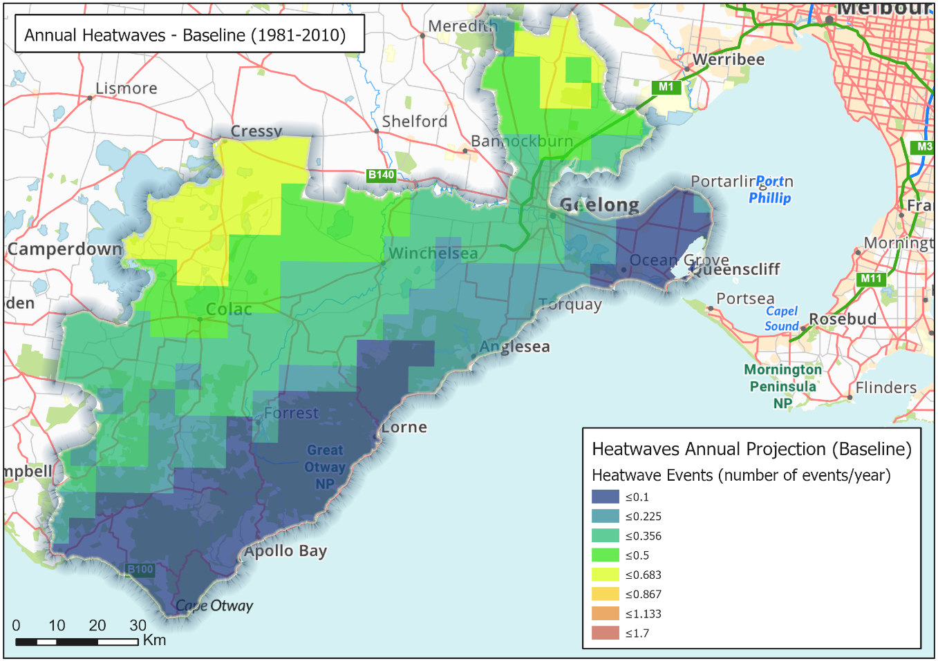
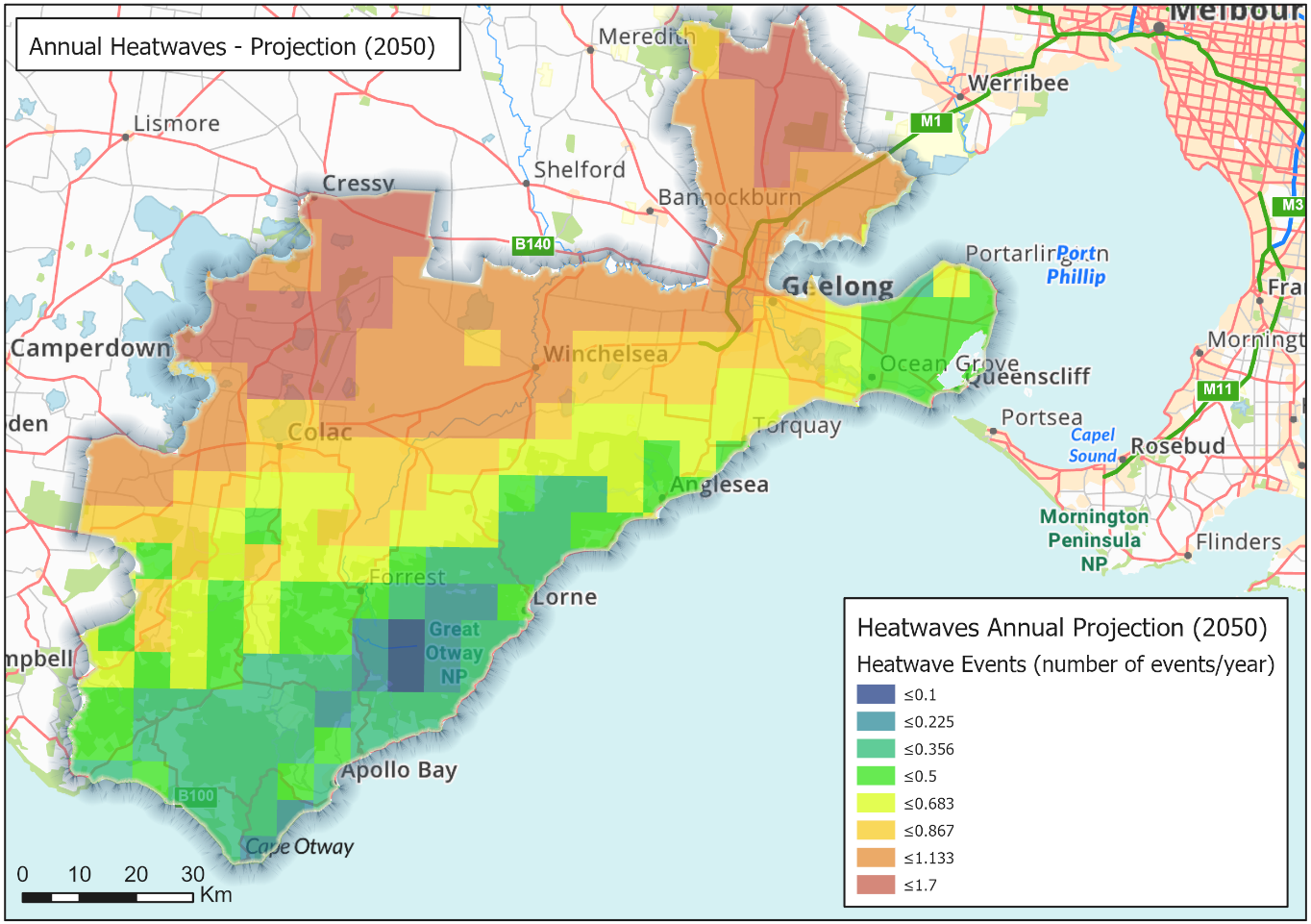
A key component of this project was the utilisation of the recent climate modelling data prepared by CSIRO for DELWP under the Victorian Climate Projections 2019 (VCP19) project as an outcome to the Intergovernmental Panel on Climate Change (IPCC) 5th Assessment Report (AR5), which includes downscaled modelling to a resolution of 5 km2 Victoria-wide. The climate change projection information incorporated within this project is based on a high carbon emissions scenario (RCP 8.5), for the futures 2030 and 2050. We also obtained historical climate data obtained from the last 50 years of weather observations from SILO.
These historical observation and future projection datasets allowed us to adapt the datasets into climate change variables that are of particular interest to the councils. Some examples of these variables include: the number of heatwaves per year, the number of days above temperature thresholds (35°C and 40°C) per month, and the number of days per month exceeding 10 mm in rainfall. The presentation of the CSIRO data in these different variable formats allows the councils to consume the data in a relevant format for any future climate change planning and impact mitigation. For example, the figures above highlight the increase in the number of heatwave events per year from the current climate (left) to the 2050 future (right).
Harnessing these climate datasets alongside visualisation tools and detailed impact analysis, we were able to produce six extreme weather case studies reflecting the various extreme weather hazards prioritised by the four councils and DELWP.

Of importance to this project was the empowerment of councils to prepare for these events by enhancing local capacity building within the organisations. As such, as well as providing the data in the required spatial formats, we also organised and presented the data into the open-source GIS platform QGIS, with all symbology set and ready to use and interact with. Some of the users may even use the provided QGIS viewer as a repository that they can continue to add spatial data to. The key aim here, alongside mentoring in the use of QGIS and application of the data, was to provide a tool that the councils could continue to use into the future to plan for and mitigate impacts of extreme weather events.

In summary, the role of spatial data in addressing the pressing reality of our changing climate is of critical importance for aiding decision makers by contextualising and visualising the expected impacts and consequences to our communities and assets. Empowering the councils by providing GIS visualisation tools and advancing their internal spatial capabilities is critical in preparation and response to these ever-increasing occurrences of extreme weather events.
For more information on this project, see the full case study here.
Rhiannan is our 2019 Graduate Cadet and has a passion for using GIS analysis to solve real-world spatial problems. In her spare time, she enjoys exploring the outdoors and cooking home-made cheeses.
- Building Council Capacity for Climate Change Preparedness - December 22, 2021
- Why women in STEM need mentors – a geospatial perspective - November 25, 2021
- Planning for Climate Change: An Evidence-Based Approach - November 19, 2020


