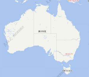
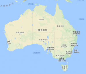
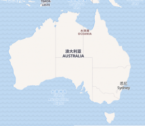
Recently, a client commissioned us to map a web map of Australia to distribute in China. Specifically, the use case called for a web map of Australia with Chinese language labels, so that Chinese native-speakers could easily interact with the map of Australia in their own language. Both states and capital cities needed labels, and of course the more readable the cartography underneath – the better.
The client need the map to show certain tax details for property investment. The news has been telling us about the property boom that has been underway in Australia for the last 5+ years, and with investment coming from overseas, it is no wonder there is demand for maps like this. But what are the options? Is there good web mapping available of Australia in languages other than English? Does it show the detail I need? We asked ourselves the same questions, and in the case of the Chinese language, came to the conclusion that we would make our own base map. But first, let’s look at the other options available.
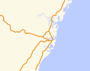
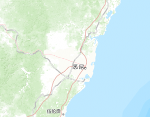
One of the interesting issues we encountered in this selection is that we didn’t really have a barometer on what cartography “feels” best to residents of mainland China. For example, in Australia, Google maps is arguably the most used web mapping service, and may “feel” the most familiar or useful to users in Australia. But the same cannot be said for users in mainland China who since 2014 have not had access to Google maps (or the rest of Google for that matter) without a VPN or proxy, due to the ban imposed by the Chinese government.That said, we are very proud of the detailed yet readable cartography on the Spatial Vision Mapscape product (for example, Castlemaine).
You can use the web maps below to compare the difference, and for more info on using our Mapscape Chinese language tiles in your own project – get in contact!
https://spatialvision.com.au/tiles/ch_tile_showcase.html
Tianditu
| Pros
+ Separate base map and annotation tilesets + Accessible via Leaflet plugin Cons – Sparse labels outside China – Cities not labelled until high zoom – Watermarked tile images |
  |
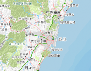
| Launched by China’s “State Bureau of Surveying and Mapping” in 2010, Tianditu (天地图) was China’s first official free mapping service. Tianditu translates to “world map” or “day map”, and while the labelling is as rich as you’d expect in China itself, it’s much sparser when you leave. The labels do exist for most towns in Australia, but strangely the language reverts to English when zoomed in. Other features like roads, national parks and so on are not labelled. The tiles are also watermarked when consumed remotely, which is bit of a let-down.
One plus is that the base mapping and label tile services are separate, if you just need labels in Chinese but want to use different cartography, you can. |
  |
Gao De
| Pros
+ Separate base map and annotation tilesets + Accessible via Leaflet plugin Cons – Very few labels outside China – Labels that do exist do not go lower than country level – Low level of detail in cartography for Australia |
 |
| Gao De (高德地图) – now known as amap – has less English language information about it than TianDiTu, but it is the web mapping product from AutoNavi, a Chinese location services and web mapping company.
Labelling is plentiful on mainland China, but it is basically non-existent outside its borders. Australia is labelled at the country level, but then Canberra is the only city labelled at higher zooms. As with TianDiTu, the labels and map base are consumable as separate services, but with labelling this sparse for Australia, it seem pretty unlikely that this will see use. |
 |
Google Chinese
| Pros
+ Familiar Google mapping base + Clear cartography with readable labels + Extensive labelling of granular features Cons – Subject to Google’s licensing (paid for commercial apps) – Labelling extensive, but incomplete – Not viewable within mainland China without a VPN |
 |
| A familiar face – Google’s Chinese language map tiles (Google地图). Anyone who has done any web mapping will know that Google’s map base is considered on basically every project, and the conclusion is usually either “we want to use Google maps because it is everywhere” OR “we do not want to use Google maps because it is everywhere”. The eternal “safe” vs. “boring” debate. I personally think that Google’s tiles are a good all-rounder, but I can see how it could look “too easy”.
For the Chinese language tiles, the cartography is Google’s flagship base map, the only thing that differs is that the labels are in Chinese. Many of the labels, but not all of them. The labels are displayed in both Chinese and English, but as the zoom level gets high you start to see more and more labels with just the English text. For our use case here, this is fine, but use of the tiles is subject Google’s licensing conditions, which requires payment for commercial uses. Yet, despite all of this, Google and its subsidiary sites are still blocked in mainland China, so the tiles will not even appear to users in China without a proxy. This uncertainty is not a good fit for our use case, so we must omit what is probably our best existing option for a map of Australia in Chinese. |
 |
Geoq
| Pros
+ Natural looking cartography + Accessible via Leaflet plugin Cons – Only labels Canberra at low zoom – Only labels cities at high zoom |
 |
| Geoq (智图GeoQ, not to be confused with GeoQ or Geo-Q) is a Chinese mapping service provider. There is no English information that I can find easily on this service, but they appear to provide open mapping APIs and other services.
As for the tiles themselves, they’ve got some nice Natural Earth-esque pastel symbology, and there are labels for major metro areas, but they are rendered at funny zoom levels – like from level 4 down to 6 the only features that are labelled are country capitals and rivers? It’s a shame, because in terms of cartography and label coverage it is probably the best option. |
 |
Open Map Tiles
| Pros
+ Vector tiles + Labels all cities at low zoom + Free for non-commercial use + Uses familiar OSM base map + Constantly growing due to crowdsourcing data + Can choose between just Chinese or Chinese & English Cons – Requires licenses for other uses – Labels incomplete at higher zoom levels (only shows major cities) – Requires installation and hosting |
 |
| OpenMapTiles is a pre-generated tile mapping service. It uses data from the OpenStreetMap project to make pre-canned tiles which it wraps in its tile server for download. This is free for non-commercial users, but must be licensed for commercial purposes.
These tiles (vector or raster) come annotated in multiple languages, including Chinese. The cartography is nice, and customisable, as it is primarily served through vector tiles. On the demonstration website, labelling of Australia in Chinese has major cities and states, but not much else. This is fine for our use case, and although not all state and city labels appear at lower zoom levels, this can be customised if you serve your own tiles. However, this brings us to the main drawback: you need to host the tiles yourself. In some ways, this affords you some freedom, as you can host them somewhere you are sure won’t be blacklisted in China. But it complicates the issue by |
 |
Mapscape Chinese
| Pros
+ Rich Mapscape cartographic mapping base + Complete labelling of national parks, suburbs, roads and so on + Customisable on request Cons – Only covers Australia |
 |
| Given that our search did not return any map base that fitted our specification well enough, we decided to make our own!
We did this using a combination of our existing Mapscape tiles and our custom collected Chinese language gazette of Australian place names which we used to create the SVmaps Australian poster map. This gave us several advantages for this use case over the other existing products:
Of course the one drawback is that Mapscape tiles only cover Australia, but that fits our use-case just fine. |
 |
For more information, please call on 1300 366 796, email here or visit http://spatialvision.com.au
Some tips on making web-maps for an audience in mainland China:
- If you are using Leaflet, check out Leaflet.ChineseTmsProviders. It’s a shortcut library for using map tiles from a set of Chinese WMTS providers. You can add them easily to your projects without having to speak Mandarin!
https://github.com/htoooth/Leaflet.ChineseTmsProviders - If you’re curious about what other sites are blocked in China, plug in the URL at the Great Firewall site for a detailed account.
https://en.greatfire.org/analyzer
Tom completed a Master’s degree in Geospatial Information at RMIT in 2015 and has worked on various web-based mapping projects on a freelance basis until he came to Spatial Vision.
- GeoNetwork and Spatial Metadata Cataloguing - March 3, 2020
- Getting Started with Power BI Part 2 - July 12, 2019
- Getting Started with Power BI Part 1 - July 4, 2019