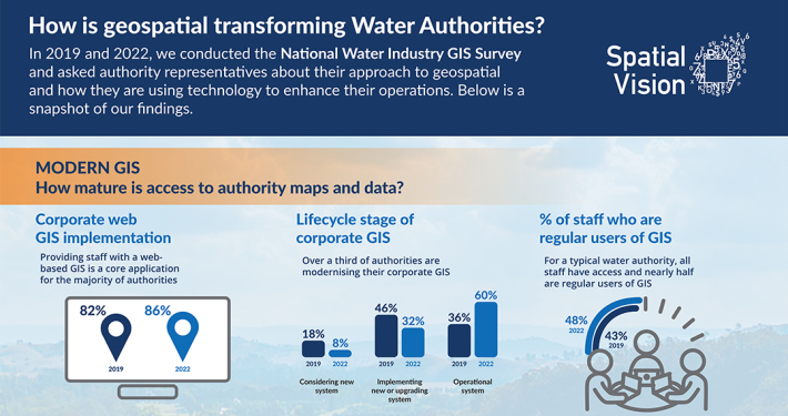
Can machine-learning be used to identify occupied ground surface car spaces?
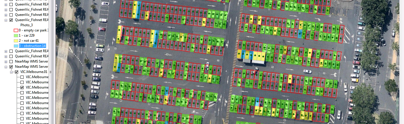
The School of Global, Urban and Social Studies (GUSS) within RMIT University recently undertook a pilot project to determine the feasibility of using machine-learning ability to identify occupied ground surface car spaces using aerial photography (NearMap) and satellite imagery from Sentinel-2.
GUSS required a set of databases that benchmark known car park spaces occupied during the Sentinel-2 satellite flight path overhead. These occupied and unoccupied car spaces were identified so that automated processes could be developed to identify occupancy using high resolution aerial photography and low resolution satellite imagery.
For the low resolution satellite imagery, GUSS requested Spatial Vision to assist in identifying possible time and date matches between Sentinal-2 satellite imagery and NearMap photography with the aim to identify satellite imagery responses which will accurately reflect the presence or absence of vehicles within a carpark. This was in order to “train” image recognition software to identify Sentinel-2 image pixels which have a complete presence, complete absence or partial presence of vehicles.
The following images are examples that were used for training the software:
  |
  |
  |
  |
| Unoccupied | Occupied | Noise | Not Car |
Spatial Vision approach was to build a GIS editing environment of the car park sites to determine the occupied and unoccupied sites. An automated process was built to produce image samples for the machine learning. The team used Spatial analytics to determine the Occupancy and Utilisation during key time and date matches aligned with the Sential-2 flight path cells across the car park sites. GIS was used to collate, store and process the aerial imagery into an ESRI file geodatabase and then deliver the ESRI geodatabase to GUSS for further analysis within their project.
For more information, please get in touch