NSW releases innovative new map series
A next generation digital centric NSW topographic map series has just been officially released by DCS Spatial Services.
While other State’s base maps offer options such a topographic, imagery and greyscale, nearly all of these base map options are delivered in raster formats. This DCS Spatial Services collaboration with Spatial Vision offers all these traditional and new unique map design options in the newer vector format, elevating NSW’s base maps to be at the cutting edge of state-wide maps in Australia.
Nine different versions of vector tile maps can be viewed at the click of a button. The functionality is such that cartophiles and non-cartophiles alike could easily lose themselves zooming in and around for hours, or days even!
Ideal for use with GPS and navigation apps on tablet and smart phone device, these maps feature modern, user-friendly visualisation that includes auto generated layers and geo-referenced PDF topographic maps. Whilst auto-generated, significant improvements have been made to the visualisation and aesthetics of the map series, including cartographic enhancements and legibility of the new product.
A new user-friendly “NSW Topographic Map” viewer can also be accessed on the Spatial Collaboration Portal. For the first time the most recent release can be viewed in addition to a historical range of auto generated topographic maps, all of which are freely available to download, use, print and share. Users can download a series of maps over an area of interest and undertake basic change analysis or explore the history of their area.
For more information on the role Spatial Vision’s experts played in this project, click here.
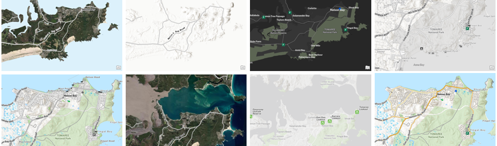
High-performance vector tile versions tailored for various situations and purposes.
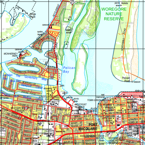
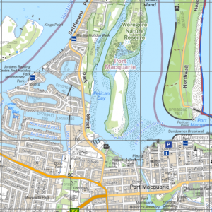
2017 sheet map (left) comparison with the new, more legible 2022 version that addressed significant accessibility issues for visually impaired users.

