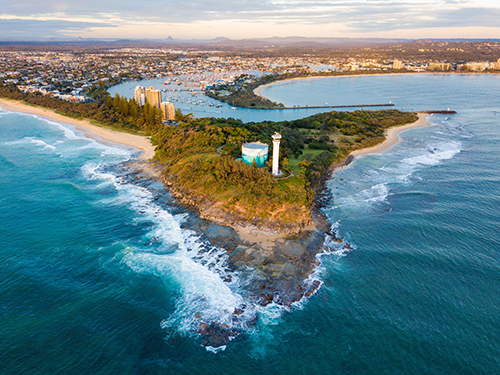
Bushfires are synonymous with the history of Australia, pre and post European settlement. Clearly this bushfire season has been unprecedented in severity, duration and extent.
Queensland was first impacted by severe bushfires in August 2019. Prolonged drought and strong positive Indian Ocean Dipole-influenced weather conditions kicked the QLD season off earlier than usual.
Northern NSW then faced a series of large uncontained bushfires in September, once again unusually early. Over the next few months, large bushfires were then reported further down the NSW coast, in Victoria, South Australia, Western Australia and Tasmania. Fires in all these jurisdictions are not unusual, however the scale, ferocity and early timing are unprecedented.
At this time in late January we still potentially have several more months of heightened bushfire risk to come.
For most informed scientists, bushfire experts and weather observers we are witnessing the unfurling of climate change scenarios long since forecast. In the 2008 Garnaut Climate Change Review, which examined the scientific evidence around the impacts of climate change on Australia and its economy, Professor Ross Garnaut predicted that without adequate action, the nation would face a more frequent and intense fire season by 2020. Greg Mullins, the former chief of NSW Fire and Rescue and 22 other former fire, SES and national park fire chiefs, were warning that 2019-20 had the hallmarks of a disastrous fire season well in advance of the first fires.
Common sense should tell us that in times of crisis we should turn to authoritative and reliable sources for advice.
There has been much published about fake or misleading maps distorting the scale of the disaster. Common sense should tell us that in times of crisis we should turn to authoritative and reliable sources for advice. Australia’s emergency services and governments have done an incredible job in keeping communities informed of threats using every available media channel. This was a key learning from the 2009 Black Saturday Royal Commission.
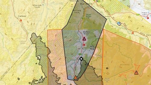
There is a bushfire on the northwest side of Mt Buffalo that is threatening the Buffalo River Valley. The fire is not yet under control. (VicEmergency). Published by Channel 9 News 17th January 2020.
The Victorian Government should be commended for utilising their own, rich Vicmap data resources to communicate threats to the community via the VicEmergency app and website*. Arguably Vicmap data provides an unrivalled level of detail across the State, particularly regional Victoria helping people to make informed decisions. The government is backing their investment in maintaining their own geospatial data products. Importantly this data is freely available under Victoria’s open data arrangements (see data.vic.gov.au).
Given the prospects of more frequent dangerous events in the near term and beyond, government investment in maintaining reliable geospatial data is crucial. This year’s events have also highlighted the importance of authoritative map-based information to keep the community informed.
*The basemap in VicEmergency is a topographic view of Vicmap data designed and published by Spatial Vision called Mapscape.
Graeme is passionate about devising solutions using geospatial information to assist people to make decisions. Graeme is Spatial Vision’s General Manager for Operations and still leads major consulting projects for customers.
For over 25 years Graeme has assisted a range of organisations with strategic advice, design of bespoke information systems, stakeholder engagement and skills transfer.
Graeme has worked across a range of sectors including international development assistance, emergency services, water utilities, natural resource management, commercial services and local government.
- Get Your GIS Strategy Going - May 25, 2021
- SDG Business Reporting: An SME Example - May 21, 2021
- Remember 2020? - December 15, 2020