")
As the world’s reliance on ship-based transportation of goods and people increases, so too are the number of incidents where vessels strike cetaceans such as whales. Sadly, for some of our most magnificent sea creatures, this often means horrible, if not fatal injuries.
Around the globe this dangerous phenomenon occurs. Between 2009 and 2014 the International Whaling Commission received over 1,200 such reports. Fear of repercussions renders many more incidents unreported. Given roughly 180,000 vessels ride the water at any given time, it’s no surprise ship strikes are one of the most common causes of death or injury for whales, dolphins, porpoises and sea turtles. Besides collisions, the presence of boats can disturb and alter essential activities such as foraging, resting, communicating, mating and nursing calves.
British Columbia – Whale Central
The busy shipping waters of British Columbia (BC) is a concentrated whale hot-spot. A dozen of the 23 species of cetaceans and sea turtles found in this area are listed under Canada’s Species at Risk Act as Endangered, Threatened, or of Special Concern (including critically endangered southern killer whales). British Columbia comprises over 25,000 km of coastline, making traditional scientific monitoring efforts both time consuming and expensive. As a solution, Ocean Wise created the BC Cetacean Sightings Network, a citizen science initiative that collects sightings of cetaceans (whales, dolphins and porpoises) from mariners, researchers, and coastal citizens. However, from 2000-2015, making a report was somewhat cumbersome, either via a toll-free phone line, web form, email or a paper logbook.
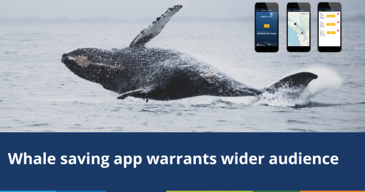
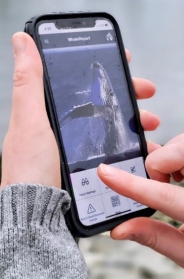
Consequently, Spatial Vision’s Mobile & IT division (now known as Lapis) was engaged by Ocean Wise to develop a solution to provide a timely, simple and powerful tool for submitting sighting reports, while taking advantage of mobile device functionality such as camera and GPS. The WhaleReport app enabled the public to report sightings immediately via their mobile phones with high locational accuracy. Used across British Columbia by whale watching operators, lighthouse keepers, charter boat operators, tugboat captains, BC Ferries personnel, researchers, government employees, recreational boaters and coastal residents, over 8,900 sightings were submitted in the first 24 months. The app now accounts for over 94% of all sighting reports.
 Source: Coastal Ocean Research Institute, Ocean Wise
If there is no Wi-Fi reports can be stored and resubmitted later. In March of this year a web version of the app was released. This facilitates reporting in areas of unreliable mobile service such as British Columbia’s north coast and southern Alaska.
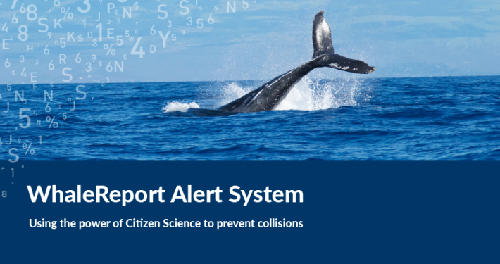
WhaleReport Alert System
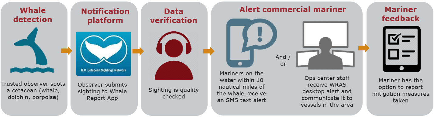
WhaleReport’s success in increasing sighting reports led to the development of the WhaleReport Alert System (WRAS) to utilise the real-time whale location information received through the app to alert commercial vessel operators of whales in their travel path. These alerts are used by skippers to take mitigation action. This entails slowing down or diverting course to reduce the risk of collision and disturbance. Large, high-speed vessels capable of travelling at speeds of up to 35 – 40 knots are a major concern as they correlate to an increase in collisions. According to a 2001 study, 89% of incidences where whales were severely hurt or killed happened when vessels travelled faster than 14 knots. Modern hull shapes are also particularly hazardous to cetaceans.
 Consistently high levels of reporting and trust in the quality of reports has been integral to WRAS’ success, helping reduce vessel-associated whale impacts. Since its inception, the WRAS has delivered more than 22,700 WRAS alerts to 60 marine partner organizations throughout British Columbia and Washington State, including BC Ferries, Washington State Ferries, BC Coast Pilots, Puget Sound Pilots, and the Canadian and US navies. The report database is also the primary source of information on the occurrence of cetaceans and sea turtles in British Columbia waters, and spatial and temporal trends in their abundance. Subsets of these data are provided to over 15 conservation-based research projects annually.
All Aboard Whale Reporting
The BC Cetacean Sightings Network (BCCSN) has adopted a “boots on the ground” approach to engaging coastal citizens and encouraging them to use WhaleReport to report their cetacean sightings. As a result of this effort, the BCCSN has built a strong and diverse network of over 7,500 observers throughout the province. The BCCSN has never extended its outreach efforts to Washington State. Hence, WhaleReport is used much less frequently to report animals south of the border. So that more alerts are provided to mariners in Washington State waters, Ocean Wise is partnering with the Acartia Data Cooperative (acartia.io) to create a general API which can ingest reports generated from other sightings apps commonly used in Washington State. This lays the groundwork for other sightings network apps to contribute to the WRAS.
Ocean Wise and the Vancouver Fraser Port Authority Enhancing Cetacean Habitat and Observation (ECHO) Program are now countering times of poor visibility or reception. A pilot project incorporates automatic detections of whales generated from hydrophones (underwater microphones which are calibrated to detect whales). Acoustic and other sighting reports will both be consumed by WRAS. How these detections will be visualized on the WRAS will be determined by the technical subcommittee composed of WRAS end users and researchers. Spatial Vision’s Lapis team are currently developing both the API and the display elements. Sighting reports will use the existing WRAS display paradigm whilst a new paradigm will be created for acoustic reports.
Reporting in Australia
Given Australia’s vast coastline and abundance of marine animals therein, it seems logical a modern mega fauna report system should be implemented here. A review of online media archives and government reports suggests that vessel strikes in Australia may account for almost 15% of worldwide incidents, albeit data from all parts is unreliable. The 2013 Federal Government report into managing whale and dolphin incidents neglected to mention impacts with vessels. Meanwhile, the national online reporting form for collisions, referred to in the 2017 national vessel strike strategy document, is a time consuming method of reporting, limited to collating data and with no capacity to provide real-time alerts to vessel operators.
With ingenuity, and by harnessing technology, like-minded organisations and a growing public concern for the environment, there is surely scope for many other similar ‘citizen science’ initiatives to conserve precious wildlife – both on land and at sea.
For further information, please contact Spatial Vision at info@spatialvision.com.au
- Getting the most out of your GIS strategy & investment - July 24, 2024
- Climate Change & Homelessness: Understanding the Connection - July 24, 2024
- Navigating the complexity of geoscience data analysis - July 24, 2024