Assessing the Impact of Climate Change
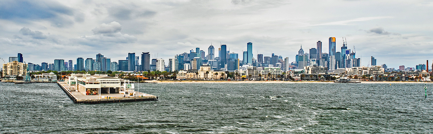
with the City of Port Phillip
Despite governments around the world taking initiatives to reduce greenhouse gas emissions, Australia is already being exposed to, and will continue to experience, the effects of climate change. Within the coming decades, Australia is expected to have more frequent extreme weather events, such as heatwaves and storm surges, on top of continued sea level rise and other climate changes. Climate change and extreme weather events place the community at risk, particularly those with higher vulnerability such as the elderly and young, as well as placing financial and physical stress on infrastructure and resources.
In response, many local governments are taking action to mitigate damages and prepare for future climate change and extreme weather events. In particular, City of Port Phillip (CoPP) requested the support of Spatial Vision with an assessment of the likely impacts of anticipated climate change on selected council assets.
Drawing on the latest climate science and downscaled modelling available through the CSIRO, Spatial Vision conducted a first-pass asset vulnerability assessment for CoPP to assist in better understanding the likely impacts of anticipated climate change to council assets. The impact and vulnerability assessment generated an impact rating based on assessed asset sensitivity to different climate change exposure scenarios.
The assessment provided the Council with a high-level understanding of how council-built infrastructure and natural assets, such as roads and parks, may be impacted by sea level rise, storm surges and flood events, and the likely impact costs associated with these scenarios if they were to occur. Individual assets were assigned climate change asset impact pro‑les, based on their anticipated impact by:
• 1 in 100 year and 1 in 20 year overland rainfall flooding events
• Sea level rise at 20cm, 47cm and 82cm increments
• Storm surge events associated with the sea level rise increments
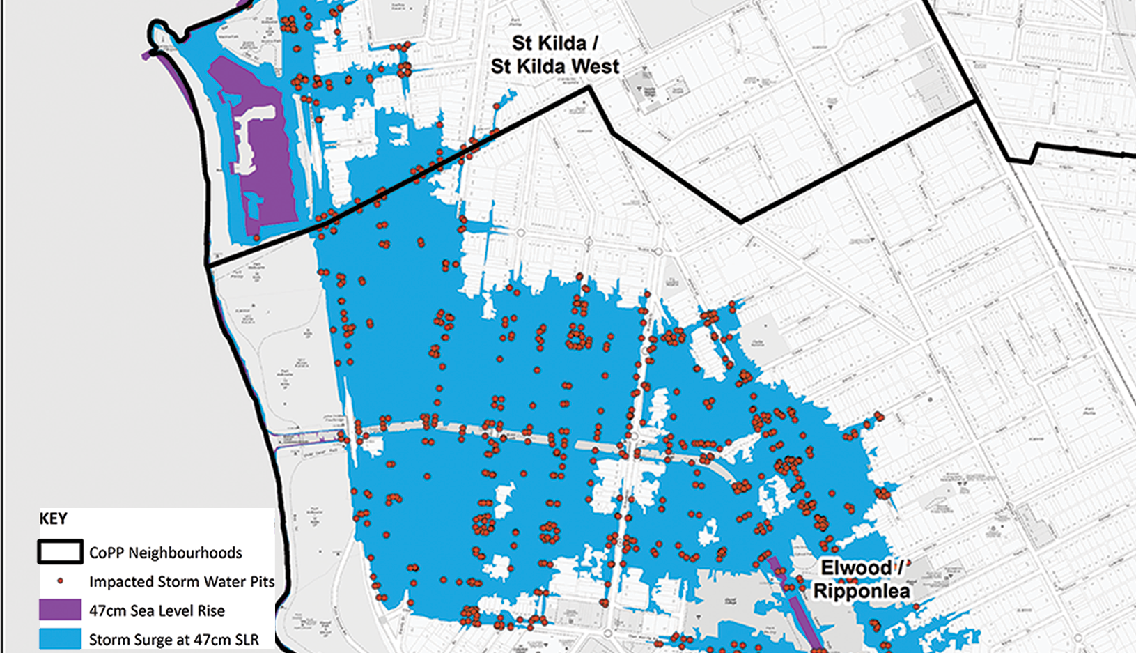
To achieve this analysis we applied the latest inundation modelling sourced from the Victorian Coastal Inundation Dataset (VCID) to determine the exposure of each individual asset to the above eight inundation scenarios. For example, the following image shows the inundation extent of a storm surge event occurring at a sea level rise of 47cm, and the impacted storm water pits within the CoPP as a result of an event such as this. This data enables the CoPP to know exactly which assets will be impacted to better prepare for these future events.
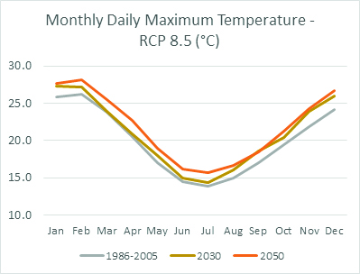
The project also included an assessment of the climate change in response to two climate scenarios, in terms of carbon emission projections (moderate and extreme), modelled for both 2030 and 2050 periods. Using the latest CSIRO climate data available, we downscaled the data to gain a deeper understanding of the likely climate changes, such as temperature and rainfall, specifically for the CoPP. By the year 2050, under even moderate future carbon emission scenarios, the latest CSIRO climate change projections suggest increases of 2.1°C and 1.8°C respectively in mean daily maximum temperatures in January and July, with increase of 1.4°C and 1.5°C respectively in mean daily minimum temperatures for these same months.
In addition to an increase in temperature, it’s expected that the frequency of warm days and heat wave events will also increase. The likely frequency of days over 35°C and 40°C has been identified to increase by 43% and 140% respectively by 2050 under even moderate future carbon emission scenarios. Similarly, the frequency of heat wave events comprising three or more consecutive days with a daily maximum temperature greater than 35°C, are expected to increase in frequency by 260% by 2050 under the same moderate future carbon emission scenario. The relationship between each asset type in terms of its anticipated sensitivity to, or the importance of, these climate related change parameters was determined.
With these types of climate changes expected for the CoPP, the first pass climate assessment conducted by Spatial Vision assists decision-making and allows CoPP to adequately prepare for asset damages likely to occur in the event of these scenarios.
For more information, please get in touch