Agriculture worldwide faces daunting challenges, not only because of increasing population growth, changing food consumption patterns, natural resource scarcity and environmental degradation, but also as a result of the rapidly intensifying threat of climate change. Australia is likely to be one of the most exposed of the world’s developed countries to the adverse effects of climatic change, especially possible declines in agricultural production.
Although the timing and magnitude of unfolding climatic conditions in the future are uncertain, they will affect natural and human systems, including major potential impacts on the economy, human wellbeing, water movement and food supply chains. Yet, at the same time, there are unprecedented positive changes and opportunities for the future, including the emergence of innovative farming practices and technological advances that have generated promising results for improving agriculture productivity.
There are two broad approaches to confront the challenges posed by climate change: mitigation and adaptation.
While mitigation aims to reduce the causes of climate change, adaptation reduces the impact of climate stress on natural and human systems. For agriculture to continue to thrive in an uncertain and risky future, we need to mitigate and anticipate the possible changes and develop and implement adaptation strategies.
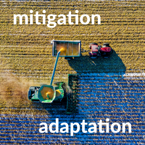
It Takes Two: Confronting climate change with both mitigation and adaptation strategies
Australian agriculture is at a pivotal point in its history with the confluence of a number of powerful drivers of change. These, aside from a rapidly changing climate, include new markets and trade arrangements, socio-demographic transformations, and policy imperatives with respect to environmental concerns including carbon pollution and competition for natural resources including land and water.
It is against this turbulent context that the agriculture sector in climate-exposed regions like the North-East Victoria must meet the challenge of ensuring long-term sustainability.
Planning for the future: a case study
The Embedding Climate Adaptation in Agriculture in North East Victoria (ECAiA) Project aimed to assist the agricultural sector and local governments in the North East Catchment Management Authority (NECMA), to effectively adapt to the impacts of climate change. The project is supported by the North East Catchment Management Authority, through funding from the Australian Government’s National Landcare Program.
Spatial Vision was engaged with project partners Natural Decisions to model and spatially represent changes in key climatic factors, agricultural productivity and water balance. A core component of the project from the outset was to design and develop a suite of Climate and Agricultural Production Exploration Spatial Tools that would facilitate communication and inform users of changes in the region to key agricultural sectors.
A key to thinking strategically about agriculture and food production is understanding that it may not necessarily be possible to produce tomorrow what is produced today.
The project utilised existing and readily available data of relevance to assess climate change impacts on agricultural productivity at a regional scale. Data and information, supplemented by local knowledge was synthesised, analysed and presented to make it clear and easy for end users to integrate information, develop knowledge of how climate change impacts their businesses and operations, and plan and manage for the future.
These were to be suitable to support discussion around managing the impacts of climate change and to equip the agribusiness sector and local governments in North East Victoria with the tools and knowledge ‘resources’ to articulate the likely impacts of climate change on the dominant agricultural sectors.
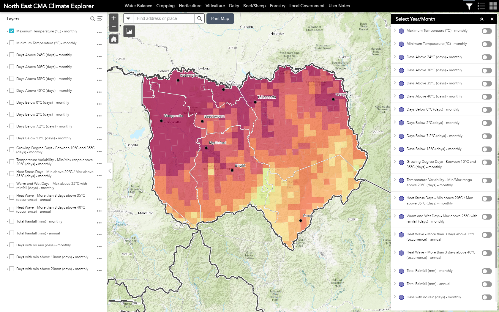
The Climate Explorer allows key climatic factors to be filtered and visualised, including maximum temperature monthly.
The suite of tools, consisting of the Climate Explorer, Production Explorer and Water Explorer, as designed by Spatial Vision and Natural Decisions through a number of industry workshops, was implemented on the North East CMA ArcGIS online instance in the form of several web-mapping applications. This incorporated a series of available tools and widgets such as filtering and customised graphing functionality to allow the user to visualise and plot the difference between three time frames for the various climatic factors or agricultural commodities.
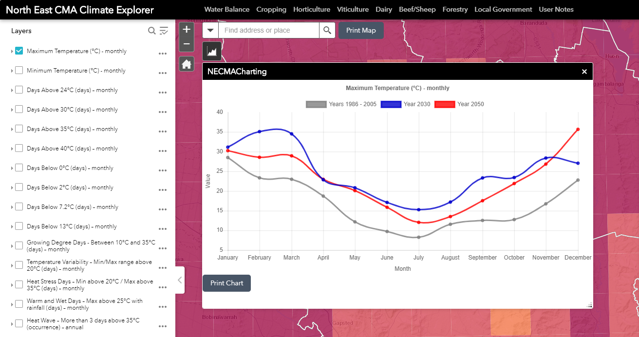
Maximum temperature monthly is depicted over three time frames, indicating past, present and future trends.
Current climate information was acquired through the SILO historic climate data repository, hosted by the Queensland Governments Long Paddock Project. Climate change data for the future years of 2030 and 2050 was sourced from the CSIRO for an applicable Global Climate Change Model and emissions scenario for the region. Both were furnished and downscaled to a 5km2 grid in northeast Victoria. Agricultural production and water balance were processed through the Catchment Analysis Toolkit (CAT) model and validated through a series of on-ground truthing exercises with local producers and relevant industry sectors.
The tools developed involved publishing data as a series of ArcGIS web services that would in turn be consumed by several separate ArcGIS online web applications, one for each agricultural industry sector or climatic element. This included a focus on climatic factors, including heat waves, rainfall patterns and water balance issues.
Climatic factors
An important aspect to these web-mapping applications was a series of derived climatic factors and water balance outputs. A series of individual agricultural sector workshops identified a set of key climatic indices to be mapped and used in subsequent web applications. These, apart from the display of temperatures and rainfall values, included:
- heat waves

- days above 35°C
- days below 0°C
- days with temperature between 10°C and 35°C
- days with no rain
Overall, 20 individual climatic factors were derived from historic climatic data and future projections into 2030 and 2050.
An understanding of where water deficiencies are likely to occur, how water supplies and water movement may be altered in potential climate futures and where opportunities may lie are key founts of information and potential drivers of change. Water balance was derived from climate inputs and land use considerations and processed in the CAT model. Outputs such as surface runoff, groundwater recharge and evapotranspiration were mapped for the region through the model and the relevant climate inputs.
From these climate inputs and water balance considerations, the CAT model was able to output, for six major agricultural industries in the North East CMA, predictive production grids for a historic climate, base off averages between 1986 and 2005, and future climates of 2030 and 2050.
The impacts of climate on plant growth
The geographic distribution of plant species, vegetation types and cropping patterns demonstrates the strong influence that climate has on plant growth. Solar radiation, temperature, precipitation, general water availability and seasonal patterns are key determinants of plant development through a variety of direct and indirect effects.
On the shortest and smallest temporal and spatial scales, the climate affects the plant’s immediate environment and thus directly affects physiological processes. On longer and larger time and spatial scales, the climate influences the distribution of species and community composition as well as determining what crops can be viably produced in managed agro-ecosystems.
Australian agriculture and its key industries are being exposed to rapid, intensive and extensive transformations associated with the influences of various drivers of change. Consequently, our farmers are facing unprecedented pressures and uncertainties. At the same time, exciting new opportunities are emerging. These changes will be far-reaching and will have a profound and lasting impact on agriculture and forestry production over the coming decades across Victoria and Australia.
A key to thinking strategically about agriculture and food production is understanding that it may not necessarily be possible to produce tomorrow what is produced today. Climate is a fundamental driver of agriculture development and any strategic planning for regional/rural and agriculture development must have at its core considerations for potential changes to climate.
- When to Raster vs When to Vector? A worked example - May 4, 2022
- Mapping the Future of Farming - August 9, 2019
- Great Ocean Road Erosion Impacts - January 10, 2019

