

Did you know Australia sits on one of the fastest moving tectonic plates, moving at about 7cm per year, or approximately 1.96 metres since 1994?
It may not seem a lot to worry about, however the repercussions are highly significant in terms of using equipment that relies on accurate positioning data (linked to satellite navigation), e.g. devices such as mobile phones and in-vehicle navigation.
Commencing in January 2000, GDA94 was adopted as the national geodetic datum in response to a desire for the locations of mapped features to align with the geocentric reference used by GPS receivers. The accuracy of most GPS devices at the time was to approximately 10 metres.
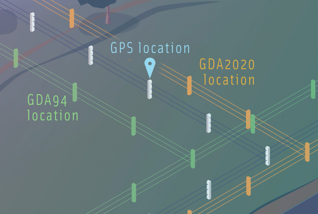
Image from icsm.gov.au
Some twenty years later, it is time to update the national geodetic reference system again. GDA2020 reflects the latest changes to the system that underlies Australia’s location information. The GDA2020 datum changes will bring Australia’s national latitude and longitude coordinates into line with global satellite positioning systems, enabling smartphones and other positioning technologies to accurately locate features marked on our maps. It will ensure Australians continue to have access to the most accurate location-based information routinely achievable and hence, a more efficient and confident exchange of spatial information between digital systems that meets the requirements of the digital age.
Adoption of the new GDA2020 datum will require some effort by all business, industry and government agencies with an investment in spatial data, systems and processes. Areas of work controlled by regulation, such as surveys or spatial data capture under Government contract are obliged to adopt GDA2020.
Other organisations utilising spatial information should already be considering, if not already completed, their plans to changes in data, systems and practices to support the adoption of the new datum.
But what does switching from the GDA 1994 Datum to the GDA 2020 Datum entail? Is it as simple as running a projection script or is it a Bermuda Triangle that Data Engineers and GIS Analysts can get lost within?
Video from Intergovernmental Committee on Surveying and Mapping. For further information on the Geocentric Datum of Australia, please visit the Intergovernmental Committee on Surveying and Mapping website.
Unless you have a well-documented log of all datasets it can be a Bermuda Triangle. Assessing what datasets you have and documenting the metadata about each of them can be a laborious task. Once you have this information, you then need to work out which dataset to project (transform), where to place the output, if the name needs to be changed (did it have GDA94 in the name?). The data is the easy bit. You then need to consider the project files, webservices etc that were linked to those original datasets.
Spatial Vision has been working with a range of clients to support them through their data transformation. We have created tools and processes to document and categorize datasets in preparation for a GDA94 to GDA2020 migration.
Our automated processes are able to go through your systems and determine:
- What data is there
- It’s metadata (including projection and datum information)
- Output a report about the status of all datasets
Once this report is produced it can be used to assist automating the data transformation process which includes transforming from its specific GDA94 projection into its sister GDA2020 projection. Its use does not stop there; it can be used to assist with renaming exercises and maintaining more specific transformation situations such as relationship classes, views and editing permission retention.
Within the world of Esri there may be extended requirements after the datasets have been transformed. Existing dataset sources may break especially if the database is different or the datasets name has changed.
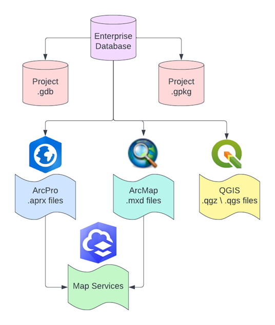
Not to forget the open-source world that utilize programs such as QGIS which may need layer sources to be updated in QGIS projects. We have experience in this domain also including use of geopackages.
Get in contact with us today to discuss your requirements and plan when migrating from GDA94 to GDA2020!
After all that heavy business, we’ll leave you with a little levity…
comic from xkcd.com
 https://spatialvision.com.au/wp-content/uploads/2024/10/Dja-Dja-Wurrung-Case-Study-web-tile.png
1356
1938
Samantha Sinclair
https://spatialvision.com.au/wp-content/uploads/2020/04/SV_Logo_Inline.png
Samantha Sinclair2024-10-17 10:13:132024-11-19 14:22:38Dja Dja Wurrung QField Solution
https://spatialvision.com.au/wp-content/uploads/2024/10/Dja-Dja-Wurrung-Case-Study-web-tile.png
1356
1938
Samantha Sinclair
https://spatialvision.com.au/wp-content/uploads/2020/04/SV_Logo_Inline.png
Samantha Sinclair2024-10-17 10:13:132024-11-19 14:22:38Dja Dja Wurrung QField Solution https://spatialvision.com.au/wp-content/uploads/2024/08/2018_DJFMA_Sentinel2_NDVI_Comparison-e1724302291370.png
350
602
Samantha Sinclair
https://spatialvision.com.au/wp-content/uploads/2020/04/SV_Logo_Inline.png
Samantha Sinclair2024-08-26 12:16:172024-08-26 13:35:21Harnessing Earth Observation (EO) to Build Climate Resilience in Urban Areas
https://spatialvision.com.au/wp-content/uploads/2024/08/2018_DJFMA_Sentinel2_NDVI_Comparison-e1724302291370.png
350
602
Samantha Sinclair
https://spatialvision.com.au/wp-content/uploads/2020/04/SV_Logo_Inline.png
Samantha Sinclair2024-08-26 12:16:172024-08-26 13:35:21Harnessing Earth Observation (EO) to Build Climate Resilience in Urban Areas https://spatialvision.com.au/wp-content/uploads/2024/08/GCA-awards_600x350.jpg
354
600
Samantha Sinclair
https://spatialvision.com.au/wp-content/uploads/2020/04/SV_Logo_Inline.png
Samantha Sinclair2024-08-26 11:38:572024-10-11 15:55:07Celebrating success at the Geospatial Council of Australia awards 2024
https://spatialvision.com.au/wp-content/uploads/2024/08/GCA-awards_600x350.jpg
354
600
Samantha Sinclair
https://spatialvision.com.au/wp-content/uploads/2020/04/SV_Logo_Inline.png
Samantha Sinclair2024-08-26 11:38:572024-10-11 15:55:07Celebrating success at the Geospatial Council of Australia awards 2024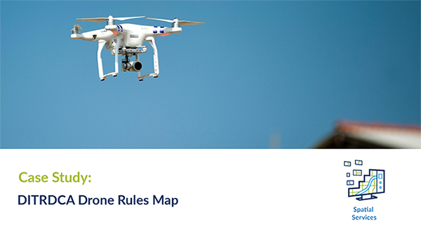 https://spatialvision.com.au/wp-content/uploads/2024/08/DITRDCA-Case-Study-web-tile-01-01-1.png
333
600
Samantha Sinclair
https://spatialvision.com.au/wp-content/uploads/2020/04/SV_Logo_Inline.png
Samantha Sinclair2024-08-22 14:09:392024-10-23 15:35:04Drone Rules Map For Public Use
https://spatialvision.com.au/wp-content/uploads/2024/08/DITRDCA-Case-Study-web-tile-01-01-1.png
333
600
Samantha Sinclair
https://spatialvision.com.au/wp-content/uploads/2020/04/SV_Logo_Inline.png
Samantha Sinclair2024-08-22 14:09:392024-10-23 15:35:04Drone Rules Map For Public Use https://spatialvision.com.au/wp-content/uploads/2024/08/DEECA-Ent-Spatial-Data-Platform-Case-Study-web-tile-01-1.png
303
600
Samantha Sinclair
https://spatialvision.com.au/wp-content/uploads/2020/04/SV_Logo_Inline.png
Samantha Sinclair2024-08-22 10:00:102024-10-23 15:32:44Enterprise Spatial Data Platform Transformation
https://spatialvision.com.au/wp-content/uploads/2024/08/DEECA-Ent-Spatial-Data-Platform-Case-Study-web-tile-01-1.png
303
600
Samantha Sinclair
https://spatialvision.com.au/wp-content/uploads/2020/04/SV_Logo_Inline.png
Samantha Sinclair2024-08-22 10:00:102024-10-23 15:32:44Enterprise Spatial Data Platform Transformation https://spatialvision.com.au/wp-content/uploads/2024/07/complexity-to-clarity-blog-image.jpg
503
900
Samantha Sinclair
https://spatialvision.com.au/wp-content/uploads/2020/04/SV_Logo_Inline.png
Samantha Sinclair2024-07-24 17:14:062024-11-12 16:22:42Navigating the complexity of geoscience data analysis
https://spatialvision.com.au/wp-content/uploads/2024/07/complexity-to-clarity-blog-image.jpg
503
900
Samantha Sinclair
https://spatialvision.com.au/wp-content/uploads/2020/04/SV_Logo_Inline.png
Samantha Sinclair2024-07-24 17:14:062024-11-12 16:22:42Navigating the complexity of geoscience data analysis https://spatialvision.com.au/wp-content/uploads/2024/07/Jarryd-Hunter_blog-image.jpg
500
900
Samantha Sinclair
https://spatialvision.com.au/wp-content/uploads/2020/04/SV_Logo_Inline.png
Samantha Sinclair2024-07-24 13:54:572024-11-12 16:07:06Meet Jarryd Hunter Manager of Enterprise Spatial Solutions
https://spatialvision.com.au/wp-content/uploads/2024/07/Jarryd-Hunter_blog-image.jpg
500
900
Samantha Sinclair
https://spatialvision.com.au/wp-content/uploads/2020/04/SV_Logo_Inline.png
Samantha Sinclair2024-07-24 13:54:572024-11-12 16:07:06Meet Jarryd Hunter Manager of Enterprise Spatial Solutions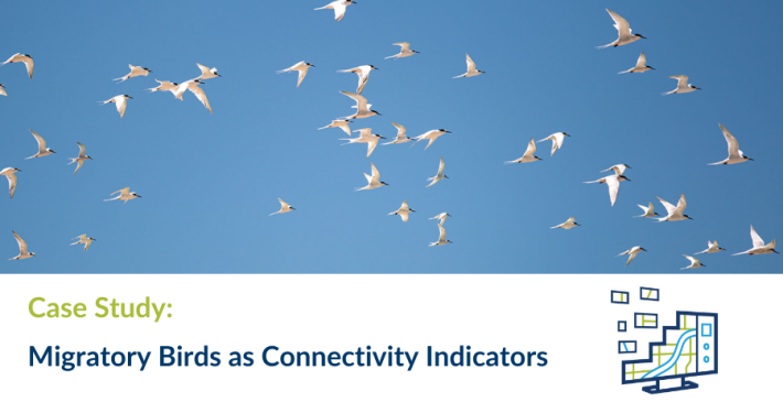 https://spatialvision.com.au/wp-content/uploads/2024/02/Case-Study-web-tile-1.png
500
900
Samantha Sinclair
https://spatialvision.com.au/wp-content/uploads/2020/04/SV_Logo_Inline.png
Samantha Sinclair2024-03-01 01:06:222024-11-12 16:24:20Migratory Birds As Connectivity Indicators
https://spatialvision.com.au/wp-content/uploads/2024/02/Case-Study-web-tile-1.png
500
900
Samantha Sinclair
https://spatialvision.com.au/wp-content/uploads/2020/04/SV_Logo_Inline.png
Samantha Sinclair2024-03-01 01:06:222024-11-12 16:24:20Migratory Birds As Connectivity Indicators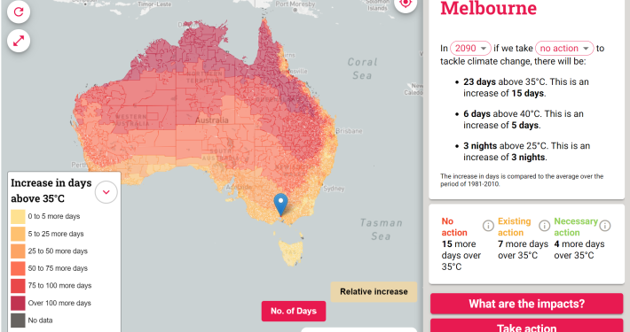 https://spatialvision.com.au/wp-content/uploads/2024/02/Heat-map-Aust.png
1404
2043
Samantha Sinclair
https://spatialvision.com.au/wp-content/uploads/2020/04/SV_Logo_Inline.png
Samantha Sinclair2024-02-28 11:19:072024-12-06 10:38:54Hot enough for you? Climate Heat Map of Australia released
https://spatialvision.com.au/wp-content/uploads/2024/02/Heat-map-Aust.png
1404
2043
Samantha Sinclair
https://spatialvision.com.au/wp-content/uploads/2020/04/SV_Logo_Inline.png
Samantha Sinclair2024-02-28 11:19:072024-12-06 10:38:54Hot enough for you? Climate Heat Map of Australia released https://spatialvision.com.au/wp-content/uploads/2024/02/Case-Study-web-tile-3.png
500
900
Samantha Sinclair
https://spatialvision.com.au/wp-content/uploads/2020/04/SV_Logo_Inline.png
Samantha Sinclair2024-02-15 13:48:392024-10-23 15:38:13Melbourne Metropolitan Open Space 30–Year Investment Opportunities Framework
https://spatialvision.com.au/wp-content/uploads/2024/02/Case-Study-web-tile-3.png
500
900
Samantha Sinclair
https://spatialvision.com.au/wp-content/uploads/2020/04/SV_Logo_Inline.png
Samantha Sinclair2024-02-15 13:48:392024-10-23 15:38:13Melbourne Metropolitan Open Space 30–Year Investment Opportunities Framework https://spatialvision.com.au/wp-content/uploads/2023/05/DCM-Blog-Covers.png
506
900
Samantha Sinclair
https://spatialvision.com.au/wp-content/uploads/2020/04/SV_Logo_Inline.png
Samantha Sinclair2023-05-30 09:34:552023-12-20 11:03:02GDA94 to GDA2020 enterprise migration
https://spatialvision.com.au/wp-content/uploads/2023/05/DCM-Blog-Covers.png
506
900
Samantha Sinclair
https://spatialvision.com.au/wp-content/uploads/2020/04/SV_Logo_Inline.png
Samantha Sinclair2023-05-30 09:34:552023-12-20 11:03:02GDA94 to GDA2020 enterprise migration https://spatialvision.com.au/wp-content/uploads/2023/02/base-maps.png
464
462
Samantha Sinclair
https://spatialvision.com.au/wp-content/uploads/2020/04/SV_Logo_Inline.png
Samantha Sinclair2023-02-06 09:19:172024-10-09 14:50:13NSW releases new base maps
https://spatialvision.com.au/wp-content/uploads/2023/02/base-maps.png
464
462
Samantha Sinclair
https://spatialvision.com.au/wp-content/uploads/2020/04/SV_Logo_Inline.png
Samantha Sinclair2023-02-06 09:19:172024-10-09 14:50:13NSW releases new base maps https://spatialvision.com.au/wp-content/uploads/2022/11/Case-Study-web-tile.png
500
900
Samantha Sinclair
https://spatialvision.com.au/wp-content/uploads/2020/04/SV_Logo_Inline.png
Samantha Sinclair2022-11-15 09:38:072025-01-28 14:51:14Case Study: Surface Permeability Analysis of Elster Creek Catchment
https://spatialvision.com.au/wp-content/uploads/2022/11/Case-Study-web-tile.png
500
900
Samantha Sinclair
https://spatialvision.com.au/wp-content/uploads/2020/04/SV_Logo_Inline.png
Samantha Sinclair2022-11-15 09:38:072025-01-28 14:51:14Case Study: Surface Permeability Analysis of Elster Creek Catchment https://spatialvision.com.au/wp-content/uploads/2022/11/NSW-Base-Maps-case-study.png
500
900
Samantha Sinclair
https://spatialvision.com.au/wp-content/uploads/2020/04/SV_Logo_Inline.png
Samantha Sinclair2022-11-03 16:11:472024-10-09 14:50:27Case Study: NSW Base Maps Vector Tiles
https://spatialvision.com.au/wp-content/uploads/2022/11/NSW-Base-Maps-case-study.png
500
900
Samantha Sinclair
https://spatialvision.com.au/wp-content/uploads/2020/04/SV_Logo_Inline.png
Samantha Sinclair2022-11-03 16:11:472024-10-09 14:50:27Case Study: NSW Base Maps Vector Tiles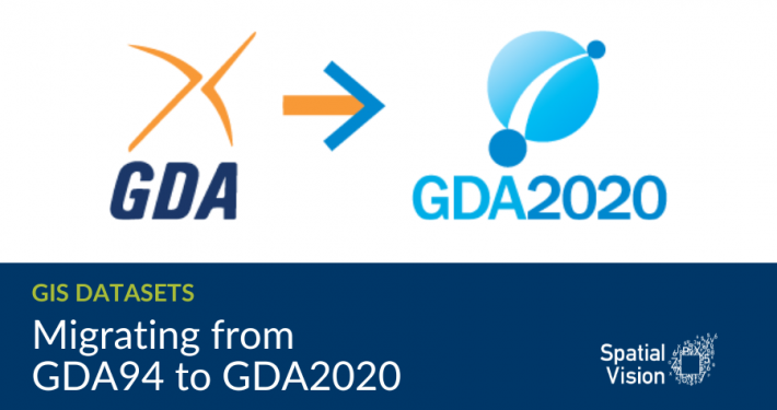 https://spatialvision.com.au/wp-content/uploads/2022/09/DCM-Blog-Covers-4.png
506
900
Samantha Sinclair
https://spatialvision.com.au/wp-content/uploads/2020/04/SV_Logo_Inline.png
Samantha Sinclair2022-09-02 13:38:032023-12-20 11:15:40Migrating from GDA94 to GDA2020
https://spatialvision.com.au/wp-content/uploads/2022/09/DCM-Blog-Covers-4.png
506
900
Samantha Sinclair
https://spatialvision.com.au/wp-content/uploads/2020/04/SV_Logo_Inline.png
Samantha Sinclair2022-09-02 13:38:032023-12-20 11:15:40Migrating from GDA94 to GDA2020 https://spatialvision.com.au/wp-content/uploads/2022/06/StockSnap_20MVZH0Y1N-1-scaled.jpg
1318
2560
Samantha Sinclair
https://spatialvision.com.au/wp-content/uploads/2020/04/SV_Logo_Inline.png
Samantha Sinclair2022-06-21 12:30:472023-12-20 11:16:32Permeability Partnership Wins Stormwater Award
https://spatialvision.com.au/wp-content/uploads/2022/06/StockSnap_20MVZH0Y1N-1-scaled.jpg
1318
2560
Samantha Sinclair
https://spatialvision.com.au/wp-content/uploads/2020/04/SV_Logo_Inline.png
Samantha Sinclair2022-06-21 12:30:472023-12-20 11:16:32Permeability Partnership Wins Stormwater Award https://spatialvision.com.au/wp-content/uploads/2022/05/pexels-pok-rie-6471927-scaled.jpg
1706
2560
Samantha Sinclair
https://spatialvision.com.au/wp-content/uploads/2020/04/SV_Logo_Inline.png
Samantha Sinclair2022-05-11 17:37:272024-10-08 16:53:39Enhancing Community Resilience to Climate Change
https://spatialvision.com.au/wp-content/uploads/2022/05/pexels-pok-rie-6471927-scaled.jpg
1706
2560
Samantha Sinclair
https://spatialvision.com.au/wp-content/uploads/2020/04/SV_Logo_Inline.png
Samantha Sinclair2022-05-11 17:37:272024-10-08 16:53:39Enhancing Community Resilience to Climate Change https://spatialvision.com.au/wp-content/uploads/2022/05/Raster-Vector-Blog-Cover-Image.png
836
1600
Harmen Romeijn
https://spatialvision.com.au/wp-content/uploads/2020/04/SV_Logo_Inline.png
Harmen Romeijn2022-05-04 23:57:302024-10-21 14:32:11When to Raster vs When to Vector? A worked example
https://spatialvision.com.au/wp-content/uploads/2022/05/Raster-Vector-Blog-Cover-Image.png
836
1600
Harmen Romeijn
https://spatialvision.com.au/wp-content/uploads/2020/04/SV_Logo_Inline.png
Harmen Romeijn2022-05-04 23:57:302024-10-21 14:32:11When to Raster vs When to Vector? A worked example https://spatialvision.com.au/wp-content/uploads/2021/06/David-graduate-cadet-cover.png
500
900
David Pepin
https://spatialvision.com.au/wp-content/uploads/2020/04/SV_Logo_Inline.png
David Pepin2021-06-17 15:06:192024-11-27 06:42:25The Journey of a GIS Graduate: 2021 Graduate Cadet Program
https://spatialvision.com.au/wp-content/uploads/2021/06/David-graduate-cadet-cover.png
500
900
David Pepin
https://spatialvision.com.au/wp-content/uploads/2020/04/SV_Logo_Inline.png
David Pepin2021-06-17 15:06:192024-11-27 06:42:25The Journey of a GIS Graduate: 2021 Graduate Cadet Program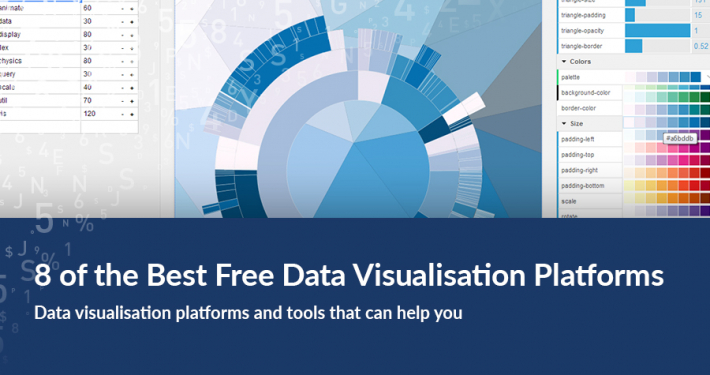 https://spatialvision.com.au/wp-content/uploads/2018/03/8-of-the-Best-Data-Visualisation-Platforms.jpg
506
900
Spatial Vision
https://spatialvision.com.au/wp-content/uploads/2020/04/SV_Logo_Inline.png
Spatial Vision2021-05-13 08:11:502024-11-14 14:44:178 of the Best Data Visualisation Platforms
https://spatialvision.com.au/wp-content/uploads/2018/03/8-of-the-Best-Data-Visualisation-Platforms.jpg
506
900
Spatial Vision
https://spatialvision.com.au/wp-content/uploads/2020/04/SV_Logo_Inline.png
Spatial Vision2021-05-13 08:11:502024-11-14 14:44:178 of the Best Data Visualisation Platforms https://spatialvision.com.au/wp-content/uploads/2020/12/Hoddle-Case-Study-cover.png
500
900
Spatial Vision
https://spatialvision.com.au/wp-content/uploads/2020/04/SV_Logo_Inline.png
Spatial Vision2020-12-02 21:06:382023-12-20 12:07:53Case Study: Hoddle Grid Heritage Review
https://spatialvision.com.au/wp-content/uploads/2020/12/Hoddle-Case-Study-cover.png
500
900
Spatial Vision
https://spatialvision.com.au/wp-content/uploads/2020/04/SV_Logo_Inline.png
Spatial Vision2020-12-02 21:06:382023-12-20 12:07:53Case Study: Hoddle Grid Heritage Review https://spatialvision.com.au/wp-content/uploads/2020/11/planningforclimatechangecover-02.png
500
900
Rhiannan Mundana
https://spatialvision.com.au/wp-content/uploads/2020/04/SV_Logo_Inline.png
Rhiannan Mundana2020-11-19 13:40:212024-11-12 16:27:11Planning for Climate Change: An Evidence-Based Approach
https://spatialvision.com.au/wp-content/uploads/2020/11/planningforclimatechangecover-02.png
500
900
Rhiannan Mundana
https://spatialvision.com.au/wp-content/uploads/2020/04/SV_Logo_Inline.png
Rhiannan Mundana2020-11-19 13:40:212024-11-12 16:27:11Planning for Climate Change: An Evidence-Based Approach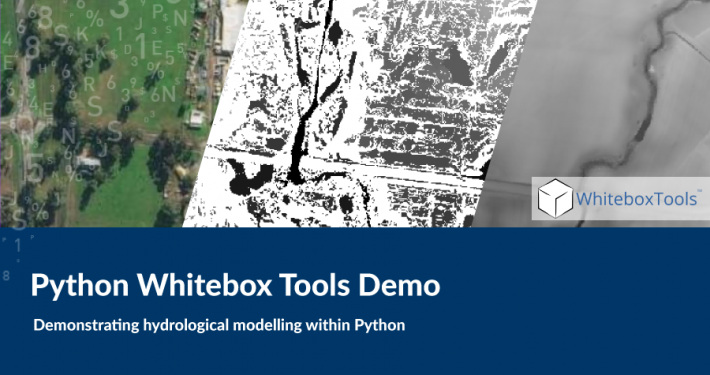 https://spatialvision.com.au/wp-content/uploads/2020/09/Python-Whitebox-cover-1.png
500
900
Spatial Vision
https://spatialvision.com.au/wp-content/uploads/2020/04/SV_Logo_Inline.png
Spatial Vision2020-09-30 05:07:172023-12-20 12:09:01Python Whitebox Tools Demo
https://spatialvision.com.au/wp-content/uploads/2020/09/Python-Whitebox-cover-1.png
500
900
Spatial Vision
https://spatialvision.com.au/wp-content/uploads/2020/04/SV_Logo_Inline.png
Spatial Vision2020-09-30 05:07:172023-12-20 12:09:01Python Whitebox Tools Demo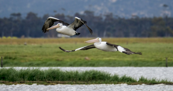 https://spatialvision.com.au/wp-content/uploads/2020/08/Lyn-Hoare-scaled.jpg
1706
2560
Spatial Vision
https://spatialvision.com.au/wp-content/uploads/2020/04/SV_Logo_Inline.png
Spatial Vision2020-08-30 08:24:332024-11-14 11:07:01Improving Accessibility of Protected Area Information
https://spatialvision.com.au/wp-content/uploads/2020/08/Lyn-Hoare-scaled.jpg
1706
2560
Spatial Vision
https://spatialvision.com.au/wp-content/uploads/2020/04/SV_Logo_Inline.png
Spatial Vision2020-08-30 08:24:332024-11-14 11:07:01Improving Accessibility of Protected Area Information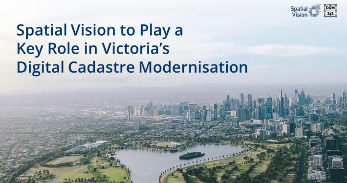 https://spatialvision.com.au/wp-content/uploads/2020/06/dcm.jpg
540
960
Spatial Vision
https://spatialvision.com.au/wp-content/uploads/2020/04/SV_Logo_Inline.png
Spatial Vision2020-06-16 13:51:002023-12-20 12:11:13Spatial Vision to Play a Key Role in Victoria’s Digital Cadastre Modernisation
https://spatialvision.com.au/wp-content/uploads/2020/06/dcm.jpg
540
960
Spatial Vision
https://spatialvision.com.au/wp-content/uploads/2020/04/SV_Logo_Inline.png
Spatial Vision2020-06-16 13:51:002023-12-20 12:11:13Spatial Vision to Play a Key Role in Victoria’s Digital Cadastre Modernisation https://spatialvision.com.au/wp-content/uploads/2020/04/Case-Study-cover.png
500
900
Spatial Vision
https://spatialvision.com.au/wp-content/uploads/2020/04/SV_Logo_Inline.png
Spatial Vision2020-04-30 22:01:012024-10-08 15:51:53Case Study: 1800 My Options
https://spatialvision.com.au/wp-content/uploads/2020/04/Case-Study-cover.png
500
900
Spatial Vision
https://spatialvision.com.au/wp-content/uploads/2020/04/SV_Logo_Inline.png
Spatial Vision2020-04-30 22:01:012024-10-08 15:51:53Case Study: 1800 My Options https://spatialvision.com.au/wp-content/uploads/2020/04/Blog-cover.png
500
900
Spatial Vision
https://spatialvision.com.au/wp-content/uploads/2020/04/SV_Logo_Inline.png
Spatial Vision2020-04-23 08:28:242023-12-20 12:12:22Introduction to 3D Data with ArcPro
https://spatialvision.com.au/wp-content/uploads/2020/04/Blog-cover.png
500
900
Spatial Vision
https://spatialvision.com.au/wp-content/uploads/2020/04/SV_Logo_Inline.png
Spatial Vision2020-04-23 08:28:242023-12-20 12:12:22Introduction to 3D Data with ArcPro https://spatialvision.com.au/wp-content/uploads/2020/03/GeoNetworkCover.png
500
900
Tom Hollands
https://spatialvision.com.au/wp-content/uploads/2020/04/SV_Logo_Inline.png
Tom Hollands2020-03-03 09:53:352023-12-20 12:12:40GeoNetwork and Spatial Metadata Cataloguing
https://spatialvision.com.au/wp-content/uploads/2020/03/GeoNetworkCover.png
500
900
Tom Hollands
https://spatialvision.com.au/wp-content/uploads/2020/04/SV_Logo_Inline.png
Tom Hollands2020-03-03 09:53:352023-12-20 12:12:40GeoNetwork and Spatial Metadata Cataloguing https://spatialvision.com.au/wp-content/uploads/2019/10/Case-Study-cover-2.png
500
900
Spatial Vision
https://spatialvision.com.au/wp-content/uploads/2020/04/SV_Logo_Inline.png
Spatial Vision2019-11-19 08:55:582024-11-27 06:57:33Case Study: Victoria Unearthed
https://spatialvision.com.au/wp-content/uploads/2019/10/Case-Study-cover-2.png
500
900
Spatial Vision
https://spatialvision.com.au/wp-content/uploads/2020/04/SV_Logo_Inline.png
Spatial Vision2019-11-19 08:55:582024-11-27 06:57:33Case Study: Victoria Unearthed https://spatialvision.com.au/wp-content/uploads/2019/10/Case-Study-cover.png
500
900
Spatial Vision
https://spatialvision.com.au/wp-content/uploads/2020/04/SV_Logo_Inline.png
Spatial Vision2019-10-16 09:00:502024-11-27 06:58:11Case Study: Wine Australia Digitised Wine Region Boundaries
https://spatialvision.com.au/wp-content/uploads/2019/10/Case-Study-cover.png
500
900
Spatial Vision
https://spatialvision.com.au/wp-content/uploads/2020/04/SV_Logo_Inline.png
Spatial Vision2019-10-16 09:00:502024-11-27 06:58:11Case Study: Wine Australia Digitised Wine Region Boundaries https://spatialvision.com.au/wp-content/uploads/2019/10/CoPPFeaturedImage.png
375
710
Spatial Vision
https://spatialvision.com.au/wp-content/uploads/2020/04/SV_Logo_Inline.png
Spatial Vision2019-10-07 11:02:592024-10-11 13:24:05Assessing the Impact of Climate Change with the City of Port Phillip
https://spatialvision.com.au/wp-content/uploads/2019/10/CoPPFeaturedImage.png
375
710
Spatial Vision
https://spatialvision.com.au/wp-content/uploads/2020/04/SV_Logo_Inline.png
Spatial Vision2019-10-07 11:02:592024-10-11 13:24:05Assessing the Impact of Climate Change with the City of Port Phillip https://spatialvision.com.au/wp-content/uploads/2019/08/Blog-cover-01.png
2084
3750
Harmen Romeijn
https://spatialvision.com.au/wp-content/uploads/2020/04/SV_Logo_Inline.png
Harmen Romeijn2019-08-09 15:26:502024-11-14 15:09:57Mapping the Future of Farming
https://spatialvision.com.au/wp-content/uploads/2019/08/Blog-cover-01.png
2084
3750
Harmen Romeijn
https://spatialvision.com.au/wp-content/uploads/2020/04/SV_Logo_Inline.png
Harmen Romeijn2019-08-09 15:26:502024-11-14 15:09:57Mapping the Future of Farming https://spatialvision.com.au/wp-content/uploads/2019/08/Case-Study-cover.png
500
900
Spatial Vision
https://spatialvision.com.au/wp-content/uploads/2020/04/SV_Logo_Inline.png
Spatial Vision2019-08-02 17:16:352024-11-27 06:56:19Case Study: Embedding Climate Adaptation in Agriculture in North East Victoria
https://spatialvision.com.au/wp-content/uploads/2019/08/Case-Study-cover.png
500
900
Spatial Vision
https://spatialvision.com.au/wp-content/uploads/2020/04/SV_Logo_Inline.png
Spatial Vision2019-08-02 17:16:352024-11-27 06:56:19Case Study: Embedding Climate Adaptation in Agriculture in North East Victoria https://spatialvision.com.au/wp-content/uploads/2019/07/Case-Study-cover-01-4.png
500
900
Spatial Vision
https://spatialvision.com.au/wp-content/uploads/2020/04/SV_Logo_Inline.png
Spatial Vision2019-07-19 15:38:542024-10-11 14:45:07Case Study: Cooling the City Pilot Project
https://spatialvision.com.au/wp-content/uploads/2019/07/Case-Study-cover-01-4.png
500
900
Spatial Vision
https://spatialvision.com.au/wp-content/uploads/2020/04/SV_Logo_Inline.png
Spatial Vision2019-07-19 15:38:542024-10-11 14:45:07Case Study: Cooling the City Pilot Project https://spatialvision.com.au/wp-content/uploads/2019/07/Blog-cover-part-2.jpg
500
900
Tom Hollands
https://spatialvision.com.au/wp-content/uploads/2020/04/SV_Logo_Inline.png
Tom Hollands2019-07-12 16:04:482024-10-11 15:53:03Getting Started with Power BI Part 2
https://spatialvision.com.au/wp-content/uploads/2019/07/Blog-cover-part-2.jpg
500
900
Tom Hollands
https://spatialvision.com.au/wp-content/uploads/2020/04/SV_Logo_Inline.png
Tom Hollands2019-07-12 16:04:482024-10-11 15:53:03Getting Started with Power BI Part 2 https://spatialvision.com.au/wp-content/uploads/2019/07/Case-Study-cover-01-1.png
500
900
Spatial Vision
https://spatialvision.com.au/wp-content/uploads/2020/04/SV_Logo_Inline.png
Spatial Vision2019-07-09 09:57:402023-12-20 12:15:57Case Study: STAR Mobile Data Capture
https://spatialvision.com.au/wp-content/uploads/2019/07/Case-Study-cover-01-1.png
500
900
Spatial Vision
https://spatialvision.com.au/wp-content/uploads/2020/04/SV_Logo_Inline.png
Spatial Vision2019-07-09 09:57:402023-12-20 12:15:57Case Study: STAR Mobile Data Capture https://spatialvision.com.au/wp-content/uploads/2019/07/Vicmap-Viewer-cover-01-1.jpg
430
1384
Spatial Vision
https://spatialvision.com.au/wp-content/uploads/2020/04/SV_Logo_Inline.png
Spatial Vision2019-07-05 11:21:242024-11-14 11:19:52Vicmap Goes Digital
https://spatialvision.com.au/wp-content/uploads/2019/07/Vicmap-Viewer-cover-01-1.jpg
430
1384
Spatial Vision
https://spatialvision.com.au/wp-content/uploads/2020/04/SV_Logo_Inline.png
Spatial Vision2019-07-05 11:21:242024-11-14 11:19:52Vicmap Goes Digital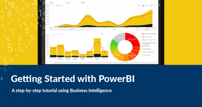 https://spatialvision.com.au/wp-content/uploads/2019/07/Blog-cover-01-2.jpg
500
900
Tom Hollands
https://spatialvision.com.au/wp-content/uploads/2020/04/SV_Logo_Inline.png
Tom Hollands2019-07-04 16:04:302024-10-11 15:52:19Getting Started with Power BI Part 1
https://spatialvision.com.au/wp-content/uploads/2019/07/Blog-cover-01-2.jpg
500
900
Tom Hollands
https://spatialvision.com.au/wp-content/uploads/2020/04/SV_Logo_Inline.png
Tom Hollands2019-07-04 16:04:302024-10-11 15:52:19Getting Started with Power BI Part 1 https://spatialvision.com.au/wp-content/uploads/2019/06/cool-routes.png
862
1384
Spatial Vision
https://spatialvision.com.au/wp-content/uploads/2020/04/SV_Logo_Inline.png
Spatial Vision2019-06-17 10:01:072023-12-20 12:16:23Cooling the City Visualisation
https://spatialvision.com.au/wp-content/uploads/2019/06/cool-routes.png
862
1384
Spatial Vision
https://spatialvision.com.au/wp-content/uploads/2020/04/SV_Logo_Inline.png
Spatial Vision2019-06-17 10:01:072023-12-20 12:16:23Cooling the City Visualisation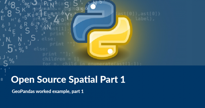 https://spatialvision.com.au/wp-content/uploads/2019/01/OSS-pt1.png
500
900
Tom Hollands
https://spatialvision.com.au/wp-content/uploads/2020/04/SV_Logo_Inline.png
Tom Hollands2019-03-20 15:58:092024-10-11 14:26:51Open Source Spatial: GeoPandas Part 1
https://spatialvision.com.au/wp-content/uploads/2019/01/OSS-pt1.png
500
900
Tom Hollands
https://spatialvision.com.au/wp-content/uploads/2020/04/SV_Logo_Inline.png
Tom Hollands2019-03-20 15:58:092024-10-11 14:26:51Open Source Spatial: GeoPandas Part 1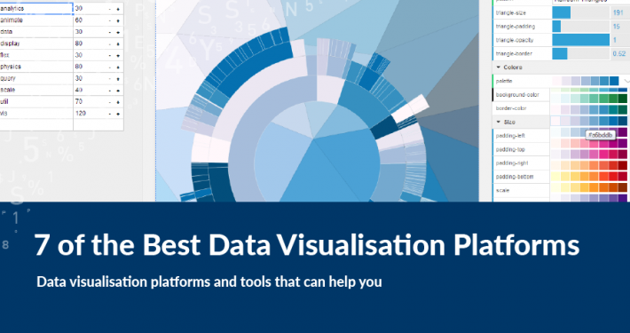 https://spatialvision.com.au/wp-content/uploads/2019/01/7-of-the-Best-Data-Visualisation-Platforms.png
500
900
Spatial Vision
https://spatialvision.com.au/wp-content/uploads/2020/04/SV_Logo_Inline.png
Spatial Vision2019-03-08 10:58:052024-11-14 14:41:117 of the Best Data Visualisation Platforms
https://spatialvision.com.au/wp-content/uploads/2019/01/7-of-the-Best-Data-Visualisation-Platforms.png
500
900
Spatial Vision
https://spatialvision.com.au/wp-content/uploads/2020/04/SV_Logo_Inline.png
Spatial Vision2019-03-08 10:58:052024-11-14 14:41:117 of the Best Data Visualisation Platforms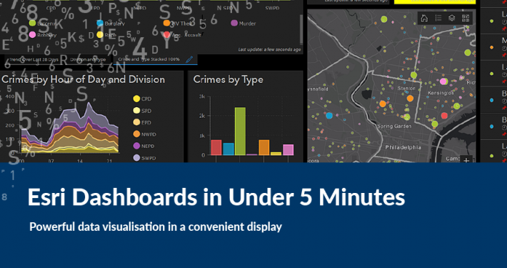 https://spatialvision.com.au/wp-content/uploads/2019/03/Dashboard-cover.png
500
900
Samantha Sinclair
https://spatialvision.com.au/wp-content/uploads/2020/04/SV_Logo_Inline.png
Samantha Sinclair2019-02-22 12:04:062024-11-14 15:18:40Esri Dashboards in Under 5 Minutes
https://spatialvision.com.au/wp-content/uploads/2019/03/Dashboard-cover.png
500
900
Samantha Sinclair
https://spatialvision.com.au/wp-content/uploads/2020/04/SV_Logo_Inline.png
Samantha Sinclair2019-02-22 12:04:062024-11-14 15:18:40Esri Dashboards in Under 5 Minutes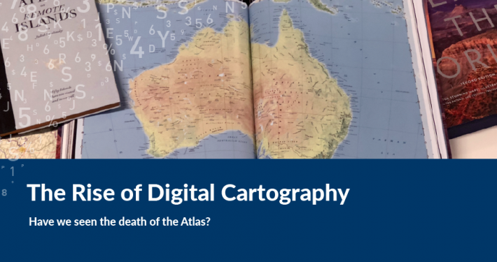 https://spatialvision.com.au/wp-content/uploads/2019/02/Atlas-Cover2.png
500
900
Spatial Vision
https://spatialvision.com.au/wp-content/uploads/2020/04/SV_Logo_Inline.png
Spatial Vision2019-02-18 00:14:292023-12-20 12:18:09Have We Seen The Death Of The Atlas?
https://spatialvision.com.au/wp-content/uploads/2019/02/Atlas-Cover2.png
500
900
Spatial Vision
https://spatialvision.com.au/wp-content/uploads/2020/04/SV_Logo_Inline.png
Spatial Vision2019-02-18 00:14:292023-12-20 12:18:09Have We Seen The Death Of The Atlas?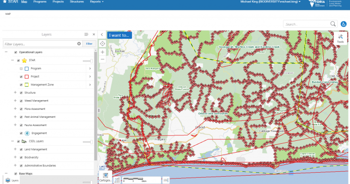 https://spatialvision.com.au/wp-content/uploads/2019/01/STAR_Bait_Stations.png
938
1652
Spatial Vision
https://spatialvision.com.au/wp-content/uploads/2020/04/SV_Logo_Inline.png
Spatial Vision2019-01-21 11:04:492023-12-20 12:18:16Field Maps and STAR: Victorian Biodiversity (Offline) Mobile Data Capture
https://spatialvision.com.au/wp-content/uploads/2019/01/STAR_Bait_Stations.png
938
1652
Spatial Vision
https://spatialvision.com.au/wp-content/uploads/2020/04/SV_Logo_Inline.png
Spatial Vision2019-01-21 11:04:492023-12-20 12:18:16Field Maps and STAR: Victorian Biodiversity (Offline) Mobile Data Capture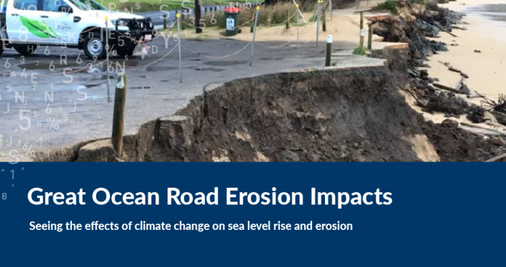 https://spatialvision.com.au/wp-content/uploads/2019/01/GOR-erosion.png
500
900
Harmen Romeijn
https://spatialvision.com.au/wp-content/uploads/2020/04/SV_Logo_Inline.png
Harmen Romeijn2019-01-10 23:00:372024-11-12 16:02:11Great Ocean Road Erosion Impacts
https://spatialvision.com.au/wp-content/uploads/2019/01/GOR-erosion.png
500
900
Harmen Romeijn
https://spatialvision.com.au/wp-content/uploads/2020/04/SV_Logo_Inline.png
Harmen Romeijn2019-01-10 23:00:372024-11-12 16:02:11Great Ocean Road Erosion Impacts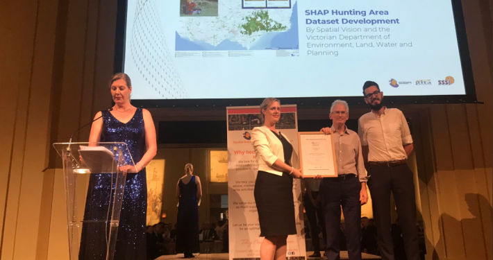 https://spatialvision.com.au/wp-content/uploads/2019/01/vsea2.png
806
1079
Spatial Vision
https://spatialvision.com.au/wp-content/uploads/2020/04/SV_Logo_Inline.png
Spatial Vision2018-12-13 10:58:392023-12-20 12:18:47Hunting Dataset Development Project Wins Award
https://spatialvision.com.au/wp-content/uploads/2019/01/vsea2.png
806
1079
Spatial Vision
https://spatialvision.com.au/wp-content/uploads/2020/04/SV_Logo_Inline.png
Spatial Vision2018-12-13 10:58:392023-12-20 12:18:47Hunting Dataset Development Project Wins Award https://spatialvision.com.au/wp-content/uploads/2019/01/adelaide_historic_street_front-e1551402068932.jpg
187
360
Spatial Vision
https://spatialvision.com.au/wp-content/uploads/2020/04/SV_Logo_Inline.png
Spatial Vision2018-11-21 10:48:532023-12-20 12:19:08Shadeways – Thermal Comfort Model
https://spatialvision.com.au/wp-content/uploads/2019/01/adelaide_historic_street_front-e1551402068932.jpg
187
360
Spatial Vision
https://spatialvision.com.au/wp-content/uploads/2020/04/SV_Logo_Inline.png
Spatial Vision2018-11-21 10:48:532023-12-20 12:19:08Shadeways – Thermal Comfort Model https://spatialvision.com.au/wp-content/uploads/2019/01/Monitoring-the-Metropolitan-Development-Boom.png
500
900
Jeremy Alcorn
https://spatialvision.com.au/wp-content/uploads/2020/04/SV_Logo_Inline.png
Jeremy Alcorn2018-08-09 10:48:202024-11-14 15:06:56Monitoring the Metropolitan Development Boom
https://spatialvision.com.au/wp-content/uploads/2019/01/Monitoring-the-Metropolitan-Development-Boom.png
500
900
Jeremy Alcorn
https://spatialvision.com.au/wp-content/uploads/2020/04/SV_Logo_Inline.png
Jeremy Alcorn2018-08-09 10:48:202024-11-14 15:06:56Monitoring the Metropolitan Development Boom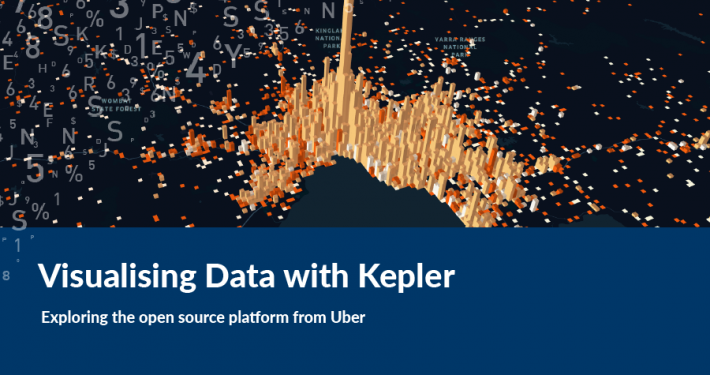 https://spatialvision.com.au/wp-content/uploads/2019/01/Visualising-Data-with-Kepler.png
500
900
Samantha Sinclair
https://spatialvision.com.au/wp-content/uploads/2020/04/SV_Logo_Inline.png
Samantha Sinclair2018-07-30 22:44:402024-11-14 15:20:19Visualising Data with Kepler
https://spatialvision.com.au/wp-content/uploads/2019/01/Visualising-Data-with-Kepler.png
500
900
Samantha Sinclair
https://spatialvision.com.au/wp-content/uploads/2020/04/SV_Logo_Inline.png
Samantha Sinclair2018-07-30 22:44:402024-11-14 15:20:19Visualising Data with Kepler https://spatialvision.com.au/wp-content/uploads/2019/01/Dealing-With-Metadata.png
500
900
Tom Hollands
https://spatialvision.com.au/wp-content/uploads/2020/04/SV_Logo_Inline.png
Tom Hollands2018-05-25 22:30:032024-11-14 15:22:16How Do You Solve A Problem Like Metadata?
https://spatialvision.com.au/wp-content/uploads/2019/01/Dealing-With-Metadata.png
500
900
Tom Hollands
https://spatialvision.com.au/wp-content/uploads/2020/04/SV_Logo_Inline.png
Tom Hollands2018-05-25 22:30:032024-11-14 15:22:16How Do You Solve A Problem Like Metadata?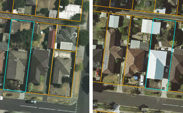 https://spatialvision.com.au/wp-content/uploads/2019/01/hdd3-e1551402118193.png
187
281
Spatial Vision
https://spatialvision.com.au/wp-content/uploads/2020/04/SV_Logo_Inline.png
Spatial Vision2018-05-10 10:25:262023-12-20 12:24:24Monitoring Housing Stock
https://spatialvision.com.au/wp-content/uploads/2019/01/hdd3-e1551402118193.png
187
281
Spatial Vision
https://spatialvision.com.au/wp-content/uploads/2020/04/SV_Logo_Inline.png
Spatial Vision2018-05-10 10:25:262023-12-20 12:24:24Monitoring Housing Stock https://spatialvision.com.au/wp-content/uploads/2019/02/1Artboard-1Concepts.png
500
900
Spatial Vision
https://spatialvision.com.au/wp-content/uploads/2020/04/SV_Logo_Inline.png
Spatial Vision2018-04-26 15:46:222024-10-08 10:55:44Case Study: Victorian Women’s Health Atlas
https://spatialvision.com.au/wp-content/uploads/2019/02/1Artboard-1Concepts.png
500
900
Spatial Vision
https://spatialvision.com.au/wp-content/uploads/2020/04/SV_Logo_Inline.png
Spatial Vision2018-04-26 15:46:222024-10-08 10:55:44Case Study: Victorian Women’s Health Atlas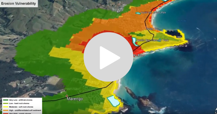 https://spatialvision.com.au/wp-content/uploads/2019/02/Untitled-design-3.png
375
710
Spatial Vision
https://spatialvision.com.au/wp-content/uploads/2020/04/SV_Logo_Inline.png
Spatial Vision2018-03-12 12:57:512023-12-20 12:32:42Video: Victorian Coastal Climate Change Impacts to Inform Monitoring Program
https://spatialvision.com.au/wp-content/uploads/2019/02/Untitled-design-3.png
375
710
Spatial Vision
https://spatialvision.com.au/wp-content/uploads/2020/04/SV_Logo_Inline.png
Spatial Vision2018-03-12 12:57:512023-12-20 12:32:42Video: Victorian Coastal Climate Change Impacts to Inform Monitoring Program https://spatialvision.com.au/wp-content/uploads/2019/02/Coastal_risks_cover.png
500
900
Spatial Vision
https://spatialvision.com.au/wp-content/uploads/2020/04/SV_Logo_Inline.png
Spatial Vision2018-02-16 13:40:052024-10-08 16:38:37Case Study: Coastal Climate Change Impact Assessment
https://spatialvision.com.au/wp-content/uploads/2019/02/Coastal_risks_cover.png
500
900
Spatial Vision
https://spatialvision.com.au/wp-content/uploads/2020/04/SV_Logo_Inline.png
Spatial Vision2018-02-16 13:40:052024-10-08 16:38:37Case Study: Coastal Climate Change Impact Assessment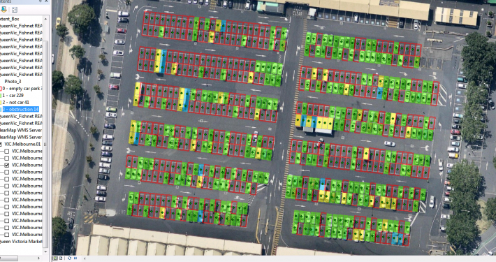 https://spatialvision.com.au/wp-content/uploads/2019/01/Site_Analysis.png
678
1403
Spatial Vision
https://spatialvision.com.au/wp-content/uploads/2020/04/SV_Logo_Inline.png
Spatial Vision2018-02-14 05:35:352024-11-14 15:11:27Can machine-learning be used to identify occupied ground surface car spaces?
https://spatialvision.com.au/wp-content/uploads/2019/01/Site_Analysis.png
678
1403
Spatial Vision
https://spatialvision.com.au/wp-content/uploads/2020/04/SV_Logo_Inline.png
Spatial Vision2018-02-14 05:35:352024-11-14 15:11:27Can machine-learning be used to identify occupied ground surface car spaces?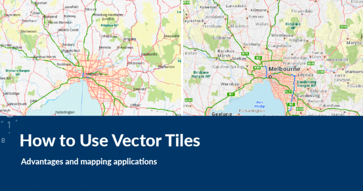 https://spatialvision.com.au/wp-content/uploads/2019/01/How-to-Use-Vector-Tiles.png
500
900
Harmen Romeijn
https://spatialvision.com.au/wp-content/uploads/2020/04/SV_Logo_Inline.png
Harmen Romeijn2018-02-12 22:04:282023-12-20 12:33:22How to Use Vector Tiles
https://spatialvision.com.au/wp-content/uploads/2019/01/How-to-Use-Vector-Tiles.png
500
900
Harmen Romeijn
https://spatialvision.com.au/wp-content/uploads/2020/04/SV_Logo_Inline.png
Harmen Romeijn2018-02-12 22:04:282023-12-20 12:33:22How to Use Vector Tiles https://spatialvision.com.au/wp-content/uploads/2017/12/78996M-e1550197988156.jpg
2273
3406
Spatial Vision
https://spatialvision.com.au/wp-content/uploads/2020/04/SV_Logo_Inline.png
Spatial Vision2017-12-20 17:31:432024-10-08 16:40:18Coastal Climate Change Impact Assessment
https://spatialvision.com.au/wp-content/uploads/2017/12/78996M-e1550197988156.jpg
2273
3406
Spatial Vision
https://spatialvision.com.au/wp-content/uploads/2020/04/SV_Logo_Inline.png
Spatial Vision2017-12-20 17:31:432024-10-08 16:40:18Coastal Climate Change Impact Assessment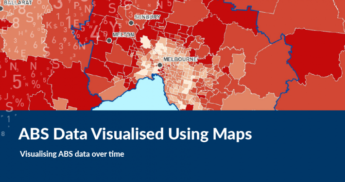 https://spatialvision.com.au/wp-content/uploads/2019/01/ABS-Data-Visualised-Using-Maps.png
500
900
Spatial Vision
https://spatialvision.com.au/wp-content/uploads/2020/04/SV_Logo_Inline.png
Spatial Vision2017-12-14 05:36:432023-12-20 12:34:10ABS Data Visualised Using Maps
https://spatialvision.com.au/wp-content/uploads/2019/01/ABS-Data-Visualised-Using-Maps.png
500
900
Spatial Vision
https://spatialvision.com.au/wp-content/uploads/2020/04/SV_Logo_Inline.png
Spatial Vision2017-12-14 05:36:432023-12-20 12:34:10ABS Data Visualised Using Maps https://spatialvision.com.au/wp-content/uploads/2019/01/Marriage-Equality-Visualisation.png
500
900
Spatial Vision
https://spatialvision.com.au/wp-content/uploads/2020/04/SV_Logo_Inline.png
Spatial Vision2017-11-29 05:32:052023-12-20 13:46:49Marriage Equality Visualisation
https://spatialvision.com.au/wp-content/uploads/2019/01/Marriage-Equality-Visualisation.png
500
900
Spatial Vision
https://spatialvision.com.au/wp-content/uploads/2020/04/SV_Logo_Inline.png
Spatial Vision2017-11-29 05:32:052023-12-20 13:46:49Marriage Equality Visualisation https://spatialvision.com.au/wp-content/uploads/2019/02/Untitled-design-2.png
375
710
Spatial Vision
https://spatialvision.com.au/wp-content/uploads/2020/04/SV_Logo_Inline.png
Spatial Vision2017-08-11 13:07:352023-12-20 14:42:17Video: Metes and Bounds Webinar
https://spatialvision.com.au/wp-content/uploads/2019/02/Untitled-design-2.png
375
710
Spatial Vision
https://spatialvision.com.au/wp-content/uploads/2020/04/SV_Logo_Inline.png
Spatial Vision2017-08-11 13:07:352023-12-20 14:42:17Video: Metes and Bounds Webinar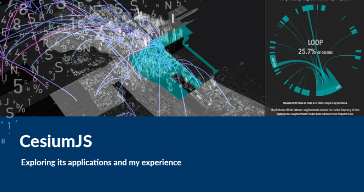 https://spatialvision.com.au/wp-content/uploads/2019/01/CesiumJS.png
500
900
Spatial Vision
https://spatialvision.com.au/wp-content/uploads/2020/04/SV_Logo_Inline.png
Spatial Vision2017-07-14 05:18:532024-10-09 14:42:34CesiumJS
https://spatialvision.com.au/wp-content/uploads/2019/01/CesiumJS.png
500
900
Spatial Vision
https://spatialvision.com.au/wp-content/uploads/2020/04/SV_Logo_Inline.png
Spatial Vision2017-07-14 05:18:532024-10-09 14:42:34CesiumJS https://spatialvision.com.au/wp-content/uploads/2019/01/Understanding-ABS-Geographies.png
500
900
Geoff Williams
https://spatialvision.com.au/wp-content/uploads/2020/04/SV_Logo_Inline.png
Geoff Williams2017-07-13 05:15:502023-12-20 14:44:00Understanding ABS Geographies
https://spatialvision.com.au/wp-content/uploads/2019/01/Understanding-ABS-Geographies.png
500
900
Geoff Williams
https://spatialvision.com.au/wp-content/uploads/2020/04/SV_Logo_Inline.png
Geoff Williams2017-07-13 05:15:502023-12-20 14:44:00Understanding ABS Geographies https://spatialvision.com.au/wp-content/uploads/2019/02/9Artboard-1Concepts.png
500
900
Spatial Vision
https://spatialvision.com.au/wp-content/uploads/2020/04/SV_Logo_Inline.png
Spatial Vision2017-07-12 11:32:362023-12-20 14:44:12Case Study: NRM Planning for Climate Change
https://spatialvision.com.au/wp-content/uploads/2019/02/9Artboard-1Concepts.png
500
900
Spatial Vision
https://spatialvision.com.au/wp-content/uploads/2020/04/SV_Logo_Inline.png
Spatial Vision2017-07-12 11:32:362023-12-20 14:44:12Case Study: NRM Planning for Climate Change https://spatialvision.com.au/wp-content/uploads/2019/02/EMET-Cover.png
500
900
Spatial Vision
https://spatialvision.com.au/wp-content/uploads/2020/04/SV_Logo_Inline.png
Spatial Vision2017-05-12 13:50:472023-12-20 14:45:04Case Study: EMET Web Map
https://spatialvision.com.au/wp-content/uploads/2019/02/EMET-Cover.png
500
900
Spatial Vision
https://spatialvision.com.au/wp-content/uploads/2020/04/SV_Logo_Inline.png
Spatial Vision2017-05-12 13:50:472023-12-20 14:45:04Case Study: EMET Web Map https://spatialvision.com.au/wp-content/uploads/2019/01/Meets-and-Bounds-image-e1549845246875.jpg
548
820
Spatial Vision
https://spatialvision.com.au/wp-content/uploads/2020/04/SV_Logo_Inline.png
Spatial Vision2017-02-09 16:50:452023-12-20 14:56:05Metes and Bounds
https://spatialvision.com.au/wp-content/uploads/2019/01/Meets-and-Bounds-image-e1549845246875.jpg
548
820
Spatial Vision
https://spatialvision.com.au/wp-content/uploads/2020/04/SV_Logo_Inline.png
Spatial Vision2017-02-09 16:50:452023-12-20 14:56:05Metes and Bounds https://spatialvision.com.au/wp-content/uploads/2019/02/12Artboard-1Concepts.png
500
900
Spatial Vision
https://spatialvision.com.au/wp-content/uploads/2020/04/SV_Logo_Inline.png
Spatial Vision2016-11-18 14:44:292023-12-20 14:56:31Case Study: Australian Electoral Commission Redistribution
https://spatialvision.com.au/wp-content/uploads/2019/02/12Artboard-1Concepts.png
500
900
Spatial Vision
https://spatialvision.com.au/wp-content/uploads/2020/04/SV_Logo_Inline.png
Spatial Vision2016-11-18 14:44:292023-12-20 14:56:31Case Study: Australian Electoral Commission Redistribution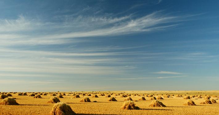 https://spatialvision.com.au/wp-content/uploads/2016/09/Nat_Rural_Hay-bales-Avoca-catchment_AVO2346.jpg
1892
2919
Spatial Vision
https://spatialvision.com.au/wp-content/uploads/2020/04/SV_Logo_Inline.png
Spatial Vision2016-09-22 16:43:492023-12-20 14:56:50FarmBuild Wins an Award
https://spatialvision.com.au/wp-content/uploads/2016/09/Nat_Rural_Hay-bales-Avoca-catchment_AVO2346.jpg
1892
2919
Spatial Vision
https://spatialvision.com.au/wp-content/uploads/2020/04/SV_Logo_Inline.png
Spatial Vision2016-09-22 16:43:492023-12-20 14:56:50FarmBuild Wins an Award https://spatialvision.com.au/wp-content/uploads/2019/02/2Artboard-1Concepts.png
500
900
Spatial Vision
https://spatialvision.com.au/wp-content/uploads/2020/04/SV_Logo_Inline.png
Spatial Vision2016-05-13 13:46:312025-01-28 15:01:59Case Study: Our Water
https://spatialvision.com.au/wp-content/uploads/2019/02/2Artboard-1Concepts.png
500
900
Spatial Vision
https://spatialvision.com.au/wp-content/uploads/2020/04/SV_Logo_Inline.png
Spatial Vision2016-05-13 13:46:312025-01-28 15:01:59Case Study: Our Water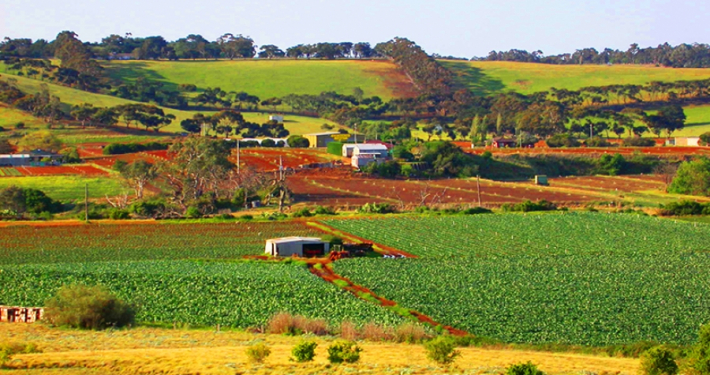 https://spatialvision.com.au/wp-content/uploads/2019/01/farmbuild.jpg
607
900
Spatial Vision
https://spatialvision.com.au/wp-content/uploads/2020/04/SV_Logo_Inline.png
Spatial Vision2016-03-30 04:32:312023-12-20 14:58:30FarmBuild
https://spatialvision.com.au/wp-content/uploads/2019/01/farmbuild.jpg
607
900
Spatial Vision
https://spatialvision.com.au/wp-content/uploads/2020/04/SV_Logo_Inline.png
Spatial Vision2016-03-30 04:32:312023-12-20 14:58:30FarmBuild https://spatialvision.com.au/wp-content/uploads/2019/02/17Artboard-1Concepts.png
500
900
Spatial Vision
https://spatialvision.com.au/wp-content/uploads/2020/04/SV_Logo_Inline.png
Spatial Vision2016-01-20 15:13:472023-12-20 14:58:52Case Study: Savanna Burning Abatement Tool
https://spatialvision.com.au/wp-content/uploads/2019/02/17Artboard-1Concepts.png
500
900
Spatial Vision
https://spatialvision.com.au/wp-content/uploads/2020/04/SV_Logo_Inline.png
Spatial Vision2016-01-20 15:13:472023-12-20 14:58:52Case Study: Savanna Burning Abatement Tool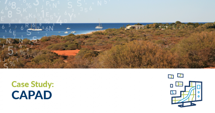 https://spatialvision.com.au/wp-content/uploads/2019/02/10Artboard-1Concepts.png
500
900
Spatial Vision
https://spatialvision.com.au/wp-content/uploads/2020/04/SV_Logo_Inline.png
Spatial Vision2015-12-21 14:50:562023-12-20 14:59:01Case Study: Collaborative Australian Protected Areas Database
https://spatialvision.com.au/wp-content/uploads/2019/02/10Artboard-1Concepts.png
500
900
Spatial Vision
https://spatialvision.com.au/wp-content/uploads/2020/04/SV_Logo_Inline.png
Spatial Vision2015-12-21 14:50:562023-12-20 14:59:01Case Study: Collaborative Australian Protected Areas Database https://spatialvision.com.au/wp-content/uploads/2019/02/16Artboard-1Concepts.png
500
900
Spatial Vision
https://spatialvision.com.au/wp-content/uploads/2020/04/SV_Logo_Inline.png
Spatial Vision2015-11-25 16:07:402023-12-20 14:59:08Case Study: Digital Radio Network Signal Strength Analysis
https://spatialvision.com.au/wp-content/uploads/2019/02/16Artboard-1Concepts.png
500
900
Spatial Vision
https://spatialvision.com.au/wp-content/uploads/2020/04/SV_Logo_Inline.png
Spatial Vision2015-11-25 16:07:402023-12-20 14:59:08Case Study: Digital Radio Network Signal Strength Analysis https://spatialvision.com.au/wp-content/uploads/2019/02/15Artboard-1Concepts.png
500
900
Spatial Vision
https://spatialvision.com.au/wp-content/uploads/2020/04/SV_Logo_Inline.png
Spatial Vision2015-06-25 14:17:032023-12-20 14:59:41Case Study: Common Ground
https://spatialvision.com.au/wp-content/uploads/2019/02/15Artboard-1Concepts.png
500
900
Spatial Vision
https://spatialvision.com.au/wp-content/uploads/2020/04/SV_Logo_Inline.png
Spatial Vision2015-06-25 14:17:032023-12-20 14:59:41Case Study: Common Ground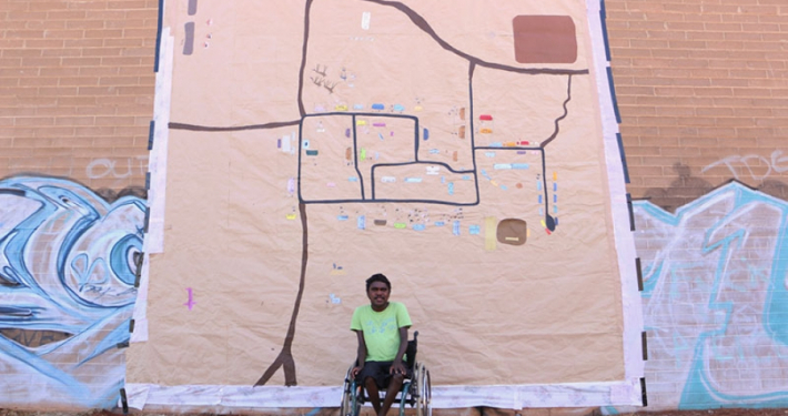 https://spatialvision.com.au/wp-content/uploads/2019/01/dion.jpg
601
900
Spatial Vision
https://spatialvision.com.au/wp-content/uploads/2020/04/SV_Logo_Inline.png
Spatial Vision2015-06-09 16:21:232023-12-20 15:00:01Digital Mapping an exhibition by Dion Beasley & Media Mob
https://spatialvision.com.au/wp-content/uploads/2019/01/dion.jpg
601
900
Spatial Vision
https://spatialvision.com.au/wp-content/uploads/2020/04/SV_Logo_Inline.png
Spatial Vision2015-06-09 16:21:232023-12-20 15:00:01Digital Mapping an exhibition by Dion Beasley & Media Mob https://spatialvision.com.au/wp-content/uploads/2015/02/visionsofvictoria1062972-302.jpg
578
864
Spatial Vision
https://spatialvision.com.au/wp-content/uploads/2020/04/SV_Logo_Inline.png
Spatial Vision2015-02-16 16:35:272023-12-20 15:00:30Land Management Database (LMDB)
https://spatialvision.com.au/wp-content/uploads/2015/02/visionsofvictoria1062972-302.jpg
578
864
Spatial Vision
https://spatialvision.com.au/wp-content/uploads/2020/04/SV_Logo_Inline.png
Spatial Vision2015-02-16 16:35:272023-12-20 15:00:30Land Management Database (LMDB)