Digital Earth in a Transformed Society

What is a Digital Earth? According to the International Journal of Digital Earth, the term refers to “…a virtual representation of the planet, encompassing all its systems and forms, both natural environment and human societies, manifested as a multi-dimensional, multi-scale, multi-temporal, and multi-layer information facility.
“I believe we need a ‘Digital Earth’. A multi-resolution, three-dimensional representation of the planet, into which we can embed vast quantities of geo-referenced data” —Al Gore, 1998 (speech)

Treat Your Team: A Reward System That Works

True agile teams are self-organizing in nature. This means that they decide how they are going to complete the work scoped for a given sprint. One thing that is usually not part of the self-organization is rewards and recognition. This is usually left with management or at a company level. We as a team decided to change this.

Spatial Vision Wins Environmental and Sustainability and Export Awards at APSEA VIC

On 18-21 June, Dr Zaffar Sadiq Mohamed-Ghouse, Executive Director – Strategic Consulting & International Relations joined global leaders in Kuala Lumpur, Malaysia for the fourth United Nations Expert Consultations and Meetings on the Development of the Implementation Guide of the Integrated Geospatial Information Framework (IGIF).

Case Study: GIS Service Plan

Melton City Council engaged Spatial Vision to develop a GIS service plan including review of its existing operational work needs.

How Do Water Authorities Use GIS?

Water is a precious and increasingly contentious resource. When we run our taps or water our gardens, we’re largely oblivious to the strategy, politics and data that goes into water policy in Australia.

Geospatial Information Systems (GIS) are widely used by the water industry for decision making and planning, management and reporting.

The UN World Geospatial Information Congress

I had the pleasure of attending the inaugural UN World Geospatial Information Congress earlier in November, along with new SV staff member, Zaffar Mohamed-Ghouse. I was there as a representative of both Spatial Vision and in my capacity of a Director of SIBA|GITA. Zaffar likewise was representing SV’s new Strategic Consulting area, and in his capacity as a President of SSSI.

Case Study: Bundaberg Geospatial Strategic Plan
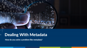
The GIS Strategic Plan delivered a roadmap of actions to better engage the business areas to support smart decision making and deliver new services to ensure more informed and satisfied customers. The strategy was developed through consultation with the various stakeholders and in close collaboration with the GIS team at BRC.

Why Do Local Governments Need GIS Strategies?

Geospatial information is part of our daily life and business. Many business areas in Local Government Authorities (LGAs) rely on Geospatial Information Systems (GIS) to deliver services to external customers or to support efficient internal daily operations.

Case Study: Business Information Model
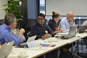
Spatial Vision developed an effective Business Information Model which provided the ability to collect the right data and information and to transform it effectively and efficiently into useful knowledge.