Sustainable Development at the Victorian Spatial Showcase

From COVID tracing to bushfire detection, geospatial technology is having a tremendous impact on the big issues of our time. This year’s Victorian Spatial Showcase & eSummit opened by the Victorian Minister for Planning the Hon. Richard Wynne showcased a number of innovative projects across Victoria that are truly making a difference to lives and livelihoods locally and internationally.

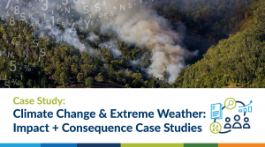
Case Study: Climate Change and Extreme Weather – Using Spatial Data for Impact & Consequence Case Studies

The Department of Environment, Land, Water and Planning (DELWP) and the Barwon Regional Partnership Councils engaged Spatial Vision to help build their capacity in the application of spatial technologies to better plan for and understand the consequences of anticipated climate change and associated extreme weather events for their communities.

Space and Spatial: A Roadmap for National Growth

Australia’s renewed focus on space presents an number of opportunities for industries to work together to strengthen our economy and future-proof our nation.

The spatial industry can play a significant role in contributing to the Government’s three key objectives for the space industry by 2030.

Case Study: National Heavy Vehicle Regulator

The NHVR engaged Spatial Vision to develop a strategy for better understanding and realising the opportunities to leverage geospatial data and technologies.

Tsunami of Data for Local Government

There has never been a more interesting time to be involved in Local Government GIS, especially in Victoria.
There is a Tsunami of new spatial data becoming available to Local Governments that may open up opportunities for delivering more spatially intelligent and reliable services.
Graeme Martin recently spoke about the challenges, opportunities and possible responses to the initiatives cropping up, and collaborative approaches to making the most of this transformative time.

Our Future and the Role of Geospatial Knowledge Infrastructure

Location intelligence can play a role in addressing many of these issues, but only if we work together.

Geospatial Knowledge Infrastructure (GKI) is essential to facilitating such collaboration, in integrating geospatial concepts, technologies and information with societal and technological change as part of a much wider digital ecosystem.

Watch the panel discussion on Advancing the Role of Geospatial Knowledge Infrastructure here.

Spatial Excellence Recognised at the APSEA Awards

Spatial Vision are honoured to have won the Environment & Sustainability category for the Embedding Climate Adaptation in Agriculture project along with the North East Catchment Management Authority and Natural Decisions. We were also delighted to have won the Export category award with our Geospatial Industry Strategy for the Kingdom of Saudi Arabia General Commission for Surveying and FrontierSI.

Q&A with Glenn Cockerton

This year marks twenty years of Spatial Vision. To celebrate this milestone, our managing director Glenn Cockerton sat down with Position magazine to reflect upon the journey, and where to next.