The Issue
Given the dramatic uptake of interest and usage of government, commercial and recreational drone technologies over the past decade, increased awareness is required for individuals and organisations to be informed of environmental or security restrictions that may apply to their drone-related flight activities.
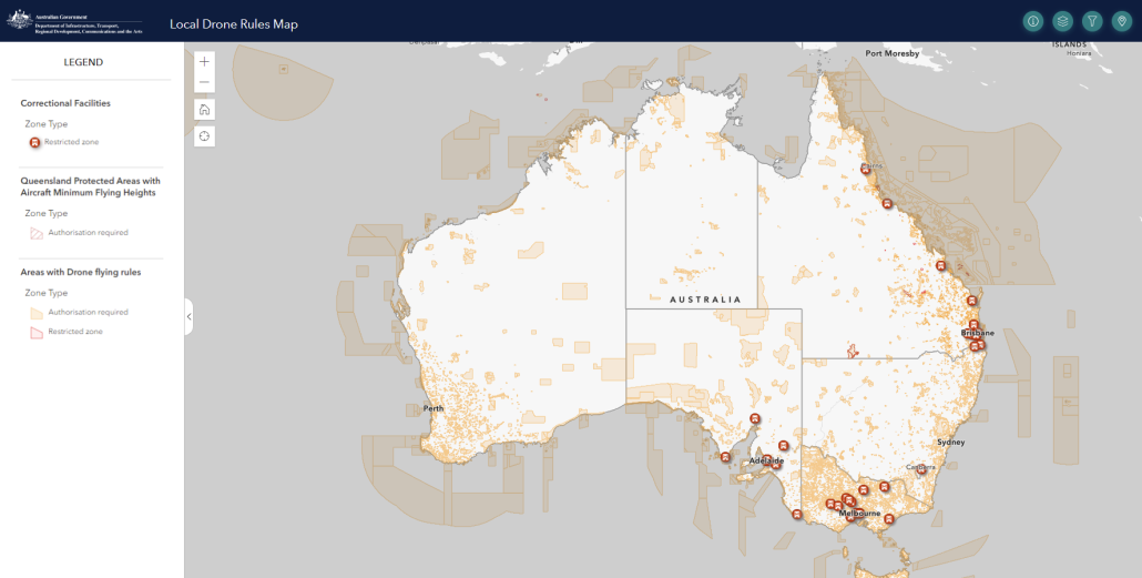
Recently, the Department of Infrastructure, Transport, Regional Development, Communications and the Arts (DITRDCA) has launched the Drone Rules Map which presents approximately 7,600 distinct restricted areas from 15 government agencies across Australia.
Importantly, the map shows non-safety drone rules, for example in National Parks and Forestry Reserves which require appropriate permissions and/or permits in order to legally operate a drone for recreational or commercial use.
The platform is intended to better inform drone pilots of areas where drone rules apply, for example in National Parks, Forestry reserves and over correctional facilities. To support and promote the accuracy of the Drone Rules Map, the department contracted Spatial Vision to improve the map via two key methods:
- Improve the accuracy of corrections facilities (currently presented as point locations on the drone rules map) to show accurate boundaries of these facilities.
- Improving the management of drone rules boundaries and attributes through conversion of original spreadsheet structure to a spatial database table.


