Advancing Climate Resilience in Tonga through Geospatial Intelligence
Supporting Pacific Island communities and gaining local knowledge is key to the Spatial Vision Pacific Geospatial Skills Development Program. Our Climate Specialist Rhiannan Mundana recently visited Tonga to mentor our 2024 program candidate Ofa Masiwawa.

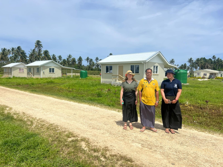
In October, I travelled to Tonga as part of Spatial Vision’s Pacific Geospatial Skills Development Program, an initiative that offers professionals from Pacific Island Countries and Territories the opportunity to build geospatial expertise with our team in Australia. This year, I am fortunate to mentor Ofa Masiwawa, the program’s current awardee, whose chosen project holds significant potential for advancing climate resilience in Tongan local communities.
Ofa’s journey with the program began in September, when she visited our Melbourne office to train alongside me and our Spatial Vision colleagues. During her time with us she gained essential geospatial skills, equipping her to take on her chosen project: a first-of-its-kind initiative to integrate spatial data within community risk profiles for a Tongan-based NGO, the Tonga National Council of Churches. The project aims to support more targeted, data-driven decision-making for climate change resilience and disaster preparedness.
The trip to Tonga was primarily dedicated to supporting Ofa in data collection and analysis for her project. Over the course of my visit, we conducted household surveys across two communities, gathering crucial data on the vulnerabilities that exist at the household level.
In addition to the surveys, we provided training for the local NGO staff on data collection methods and conducted a workshop on the basics of QGIS, a free and open-source geographic information system, to support ongoing analysis and interpretation.
For the NGO, this training means their team can now view and query data on household vulnerabilities independently — a skill set that will be invaluable in developing community profiles for climate resilience and disaster response efforts.
Looking ahead, the long-term impact of this project is promising. With community vulnerabilities now mapped and understood, local organisations have a powerful tool to support climate change and disaster management activities in Tonga. This geospatial insight will enable more precise and timely responses, directly benefiting at-risk communities.
Reflecting on the experience, I feel immensely grateful to have had the chance to work on-the-ground with Ofa. Not only has she brought incredible local insight and dedication to this project, but working collaboratively with her in her home country has been a deeply enriching experience for me. This program is a reminder of the strength of cross-cultural collaboration and the transformative power of local knowledge, when combined with the right tools and training to foster resilience in the face of climate change.
Related Articles

Pacific Geospatial Skills Development Program
The Pacific Geospatial Skills Development Program provides opportunity for an individual from a Pacific Island Country or Territory to advance their spatial skills with leading Australian spatial consultancy, Spatial Vision.

Shaping Fiji's Future Geospatial Capability
Lani Rokotuiwakaya aimed to establish how the current state of geospatial activity was impacting Fiji’s development and whether maturing geospatial capability, had the ability to positively influence organisational outcomes.

Our 2024 Pacific Islands Geospatial Skills Program Candidate
Spatial Vision is pleased to announce the successful 2024 candidate for our Pacific Islands Geospatial Skills Development Program, ‘Ofa Masiwawa from Tonga.

