
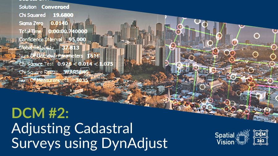
The Digital Cadastral Modernisation Adjustment Services 2 project, currently being undertaken by a consortium including Spatial Vision, Reeds Consulting and Collier Geodetic Solutions, will perform least squares adjustment of cadastral survey data on an LGA-by-LGA basis for the state of Victoria.
The data for the adjustment will come from measurements back-captured from survey plans and abstracts of field records which have been converted by the back-capture contractor into LandXML format.
The process of delivering a least squares adjustment of cadastral survey data on an LGA basis requires a robust tool. The Department of Environment Land Water and Planning (DELWP) settled on DynAdjust as the tool that offered the best solution for undertaking least squares cadastral adjustments on such a large scale.
Many spatial professionals, including some in surveying practice, may be unfamiliar with DynAdjust, for the reason that its main use prior to DCM was to adjust survey control and geodetic networks. The use of DynAdjust within a large-scale cadastral adjustment context is being pioneered by this project. 
The DynAdjust software was originally developed by Assoc Prof Frank Leahy from the University of Melbourne, with later contributions from Dr Philip Collier and more recently Dr Roger Fraser, who has transformed the code into its present operational form and has focused on enhancing its computational efficiency. Dr Fraser is now with DELWP with a lead role in the DCM Project and Spatial Vision is partnering with Dr Collier to deliver the Adjustment Services 2 stage of DCM.
DynAdjust produces both global and local test statistics to allow the adjustment results to be statistically validated. The global statistic quantifies the overall agreement of the measurements across the network, taking into consideration their individual standard deviations. Local test statistics are computed for each measurement, allowing the validity of these measurements to be individually assessed. Observations that fail the local test are deemed to be outliers and can therefore be removed from subsequent adjustments. The importance of the global and local tests is that they allow adjustment operators to find, diagnose and fix data problems and thereby deliver a final solution for cadastral node coordinates that has a high degree of statistical certainty.
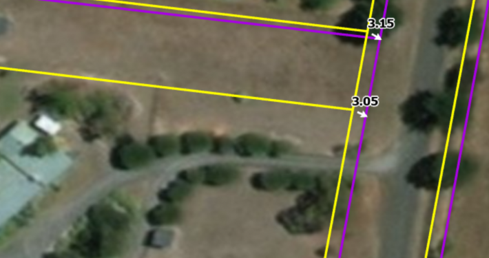
Figure 1 shows part of a typical output from DynAdjust. Of the 3480 observations in this adjustment, there is just one potential outlier. This is an observation that has failed the local test. The global (or Chi-Squared) test shows where the global test statistic (0.008) falls relative to the 95% confidence interval of 0.935 to 1.068. In this case (and typical of adjustments done to date on the DCM project) the computed global statistic falls below the lower limit of the 95% confidence interval. It is only when the value exceeds the upper limit that operator intervention is required.

Figure 1. Example of an output from a DynAdjust report for a Block in the City of Whittlesea.
Of course, not all cadastral surveys are undertaken with the same level of precision. In the adjustment process, these differences are accounted for by the assignment of apriori standard deviations to each measurement. Factors such as age of survey and length of line are used to determine these apriori values. In effect, the apriori standard deviations allow the influence of each observation on the computed coordinates to be weighted accordingly. The application of apriori standard deviations within the DCM adjustments will be discussed in a follow up blog.
DynAdjust has two unique features that make it particularly suitable for the large scale adjustment requirements of the DCM project. First, it automatically segments large, complex cadastral networks into smaller, more manageable sub-networks. Second, it adjusts these smaller networks using the phased adjustment technique, developed by A/Prof Frank Leahy, to deliver very fast adjustments of large data sets without compromising the rigour of the least squares process. A typical cadastral block, the smallest unit we are adjusting in the City of Whittlesea, may have approximately 1000 stations (parcel nodes, control points, survey marks) with 2000-2500 measurements (boundary measurements, traverses, offsets, title connections etc.). The total number of stations we will adjust in Whittlesea is likely to be in the hundreds of thousands and the observations will be in the millions. Here the power of DynAdjust is unrivalled.

Figure 2. Example of a completed block in the City of Whittlesea. Within this block there are 1616 unknown parameters (808 nodes with 2D coordinates for each). There are 3035 measurements and therefore 1419 degrees of freedom.
Our cadastral expert Tom Champion of Reeds Consulting has described his initial impression of the process of using DynAdjust and Least Squares Adjustment for adjusting cadastral plans and measurements in this project:
“ … normally (in a geodetic survey) you would have a lot of redundant measurements hinging off well established fixed stations but what we are dealing with in the DCM context is the ‘flip’ of this. We have low redundancy of measurements, and stations that are actually defined largely by VICMAP parcel nodes. The measurements themselves work pretty well together, which is testament to the high quality of work by cadastral surveyors over many years – it is the stations that are currently causing problems in the adjustment. The use of VICMAP parcel nodes as stations inherits the current limitations of VICMAP with regard to limited and simplified cadastral intent. For example the assumption that adjoining parcels share exact parcel and boundary topology.”
DynAdjust is free open source software that can be downloaded here.
The source for this document is the DynAdjust User Guide.
Jeremy’s role includes distributing and value-adding spatial data, identifying and locating spatial datasets for a variety of clients and purposes, and cleaning and restructuring data to meet client’s business needs. He has extensive experience in managing large data capture and conversion projects. Jeremy adopts spatial industry best practice for managing and distributing spatial data and contributes to consultancies requiring specialist input on the acquisition and management of spatial data.
- DCM #3: Process, progress & building a world-class team - November 17, 2021
- DCM #2: Adjusting Cadastral Surveys using DynAdjust - October 26, 2020
- DCM #1: Preparing for DCM2x2 - June 19, 2020
 https://spatialvision.com.au/wp-content/uploads/2022/09/DCM-example.png
914
1371
Samantha Sinclair
https://spatialvision.com.au/wp-content/uploads/2020/04/SV_Logo_Inline.png
Samantha Sinclair2024-07-23 04:37:162024-07-23 16:37:11Digital Cadastre Modernisation
https://spatialvision.com.au/wp-content/uploads/2022/09/DCM-example.png
914
1371
Samantha Sinclair
https://spatialvision.com.au/wp-content/uploads/2020/04/SV_Logo_Inline.png
Samantha Sinclair2024-07-23 04:37:162024-07-23 16:37:11Digital Cadastre Modernisation https://spatialvision.com.au/wp-content/uploads/2023/08/Case-Study-web-tile.png
500
900
Samantha Sinclair
https://spatialvision.com.au/wp-content/uploads/2020/04/SV_Logo_Inline.png
Samantha Sinclair2023-09-11 09:20:262023-12-20 11:04:32Case Study: Victoria’s Digital Cadastre Modernisation
https://spatialvision.com.au/wp-content/uploads/2023/08/Case-Study-web-tile.png
500
900
Samantha Sinclair
https://spatialvision.com.au/wp-content/uploads/2020/04/SV_Logo_Inline.png
Samantha Sinclair2023-09-11 09:20:262023-12-20 11:04:32Case Study: Victoria’s Digital Cadastre Modernisation https://spatialvision.com.au/wp-content/uploads/2023/05/DC-award-scaled.jpg
1707
2560
Samantha Sinclair
https://spatialvision.com.au/wp-content/uploads/2020/04/SV_Logo_Inline.png
Samantha Sinclair2023-05-12 12:16:012024-11-14 11:16:09Spatial Vision takes out national APSEA Award
https://spatialvision.com.au/wp-content/uploads/2023/05/DC-award-scaled.jpg
1707
2560
Samantha Sinclair
https://spatialvision.com.au/wp-content/uploads/2020/04/SV_Logo_Inline.png
Samantha Sinclair2023-05-12 12:16:012024-11-14 11:16:09Spatial Vision takes out national APSEA Award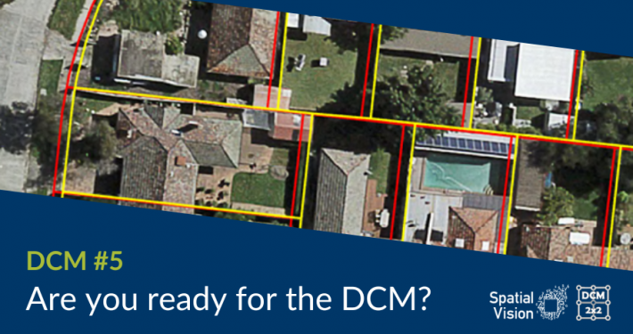 https://spatialvision.com.au/wp-content/uploads/2022/11/DCM-Blog-Covers-3.png
506
900
Samantha Sinclair
https://spatialvision.com.au/wp-content/uploads/2020/04/SV_Logo_Inline.png
Samantha Sinclair2022-11-25 16:01:272023-12-20 11:14:02Are you ready for DCM?
https://spatialvision.com.au/wp-content/uploads/2022/11/DCM-Blog-Covers-3.png
506
900
Samantha Sinclair
https://spatialvision.com.au/wp-content/uploads/2020/04/SV_Logo_Inline.png
Samantha Sinclair2022-11-25 16:01:272023-12-20 11:14:02Are you ready for DCM?