Celebrating Success at the Geospatial Council of Australia Excellence Awards
We are proud to share that Spatial Vision has been honoured with two prestigious awards at the 2024 Geospatial Council of Australia‘s Excellence Awards. These awards – the International Partnership Award and the Technical Excellence Award – underscore our dedication to innovation, collaboration, and making a positive impact in the geospatial industry. Through this recognition, we celebrate not only our team’s hard work but also the meaningful partnerships and projects that have driven our success.
International Partnership Award: Advancing Geospatial Skills in the Pacific
Launched in 2023, this Pacific Islands Geospatial Skills Development Program is designed to empower individuals from the Pacific Islands by enhancing their geospatial skills in areas critical to climate, environment, community, and sustainability. The program supports a geospatial professional to develop a project aimed at advancing geospatial infrastructure in the Pacific Islands. It’s not just a partnership—it’s about building capacity, fostering leadership, and contributing to sustainable development in the region.
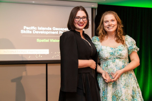
We owe a great deal of this success to Kimberley Worthy, Strategic Consultant, who played a key role in leading this program with the support of our talented team. We also recognise Rhiannan Mundana, Geospatial Climate Specialist, who is stepping into a leadership role as a mentor for the 2024 program. This recognition highlights our commitment to empowering early-career geospatial professionals and fostering stronger ties between the Pacific Islands and Australia.
Rhiannan Mundana accepting the International Partnership Award for Spatial Vision’s Pacific Islands Geospatial Skills Development Program
Kimberley Worthy
This initiative was commended for its leadership and dedication to uplifting national capabilities, setting a new benchmark for the industry. We are incredibly proud to play a role in nurturing geospatial professionals in the Pacific Islands.
Technical Excellence Award: Transforming Spatial Data Capabilities for Victoria
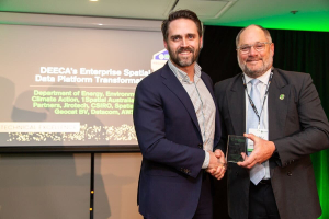
In collaboration with the Department of Energy, Environment and Climate Action (DEECA), 1Spatial Australia, Spatial Partners, Jirotech, CSIRO, Geocat BV, Datacom, and AWS, Spatial Vision has been recognised with the Technical Excellence Award for the Enterprise Spatial Data Platform Transformation project.
This project involved transitioning DEECA’s Enterprise Spatial Platforms and Services from an on-premise data centre to the AWS Cloud. The result was a robust, scalable, and cost-effective platform that ensures easy access to vital spatial data for both internal and external users. The core of this transformation is the Enterprise Spatial Data Platform, which includes the Vector, Raster, and Metadata Platforms, each playing a crucial role in supporting informed decision-making about Victoria’s natural and built environments.
We are honoured to be part of such a transformative initiative that is shaping the future of spatial data capabilities in Victoria. Read more in our full case study here.
Looking Forward
At Spatial Vision, we remain committed to pushing the boundaries of what’s possible in the geospatial industry. We look forward to continuing this journey of excellence and contributing to meaningful projects that make a difference.
Technical Excellence Award for DEECA’s Enterprise Spatial Data Platform Transformation


