Using QField For Data Collection
Frankston City Council needed to accurately capture gravesite data for almost 6,000 sites at Frankston Memorial Park cemetery, so we took on the task.
Our GIS and spatial support services provide clients with on-demand access to our team of GIS experts. They can apply their skills to your short, medium or long-term needs such as resource shortages, ad-hoc projects or fill temporary skills gaps.
Expert automation to streamline and enhance geospatial, data processing, analysis, and visualisation workflows.
Ensure seamless interoperability and bolster functionality of your existing or new geospatial infrastructure.
Detailed evaluation of vulnerabilities Services to optimise the storage, management, and retrieval of geospatial data.
Advanced geospatial analysis to transform complex spatial data into actionable insights for informed decision-making.
Cartography services to create accurate, visually compelling maps tailored to your specific needs.
Over 25 Years Experience
Our expert’s knowledge and best-practice application is derived from over 25 years in the spatial industry.
Local, on-demand
Our Australian-based team can service you nationally and internationally, online or face-to-face.
Flexible & reliable
We are not restricted by time-limits or contracts, we will collaborate with you based on your timeframes and budgets.
Our subject matter experts work with a wide range of GIS technology platforms to support the needs of customers to add the most value.
Our geospatial support services are designed to provide comprehensive and specialised support, ideal for:
– surges in demand
– on-demand, flexible expert resources
– training and mentoring
– technical trouble shooting
Using QField For Data Collection
Frankston City Council needed to accurately capture gravesite data for almost 6,000 sites at Frankston Memorial Park cemetery, so we took on the task.
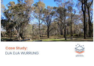
Dja Dja Wurrung QField Solution
In early 2024, DDWCAC required specialist support and training to adopt an in-field solution to collect location and species data on Dja Dja Wurrung country.
Drone Rules Map For Public Use
In early 2024, Spatial Vision was contracted by the Australian Government to improve the representation and management of drone rules across Australia to ensure clear and accurate communication to the public.
If you want to optimise your GIS workflows and overcome technical challenges, please get in contact with us.