Case Study: Victoria’s Digital Cadastre Modernisation

Spatial Vision played a key role in the digitisation and alignment Victoria’s property boundaries to produce a more accurate “single source of truth”, reducing costs and boosting productivity across both the public and private sectors, as well as increasing information accessibility.

Case Study: Golden Plains Shire Geospatial Strategy

City of Ballarat requested support from Spatial Vision in the development of a Geospatial Strategy to build geospatial intelligence and capacity to support the rapidly-expanding rural city.

Case Study: Saudi Geological Survey

Spatial Vision, working as part of a consortium, supported the Kingdom of Saudi Arabia (KSA) to develop a procurement strategy and an understanding of the Saudi Geological Survey’s requirements for KSA’s National Geological Database.

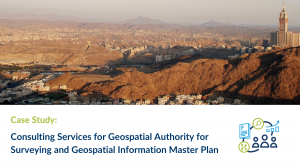
Case Study: Consulting Services for General Authority for Surveying and Geospatial Information Master Plan

Spatial Vision developed a Master Plan to define the activities necessary for GASGI to fulfill its responsibilities to deliver an effective and competitive geospatial sector within the Kingdom of Saudi Arabia.

Case Study: Surface Permeability Analysis of Elster Creek Catchment

Be it the effects of climate change or La Niña, Australia has been inundated with extreme flooding events in 2022. Spatial Vision’s award winning mapping and analysis work for E2DesignLab, Melbourne Water and affected councils in the flood prone Elster Creek catchment zone charts a course for vulnerable urban areas.

Case Study: NSW Base Maps Vector Tiles

When NSW Spatial Services’ base map offered by key platforms such as the Spatial Portals and Digital Twin needed an upgrade Spatial Vision obliged with a high end vector solution to satisfy the needs of many user groups.

Case Study: Climate Risk Map

Spatial Vision developed an interactive map of Australia for the Climate Council that represents the vulnerability of any address to the effects extreme weather over different timeframes and emission scenarios. The underlying data was supplied by Climate Valuation.

Case Study: Asset Vulnerability Assessment & Mentoring

The South East Councils Climate Change Alliance (SECCCA) engaged Spatial Vision with the support of Marsden Jacob Associates (MJA) to undertake an asset vulnerability assessment on selected assets and a financial review to assist member councils in better understanding and planning for the likely impacts of anticipated climate change.

Case Study: Land Use Analysis and Implementation Support

Spatial Vision developed a contemporary, authoritative government land use dataset to assist government in improved analysis and insight into land use. The solution supports future decision-making with precise, reliable and comprehensive evidence.

Case Study: Analysis of User Requirements & Spatial Strategy – Remote Sensing & Spatial Technologies in Water Management & Compliance

The Department of Planning, Industry & Environment engaged Spatial Vision to analyse user requirements and formulate strategies to enhance the use of spatial and remote sensing technologies across the Water branch. This resulted in the development of a two-year plan outlining 15 unique initiatives, deliverables, risks and mitigation actions to assist the Department in meeting future business requirements.