The Frankston Cemetery Data Collection Project
Frankston City Council (FCC) approached us with a unique project: collecting gravesite data for almost 6,000 sites at the Frankston Memorial Park cemetery to assist with future maintenance and audit projects at the cemetery. FCC had a gravesite dataset, containing the geometry of the sites but they had no additional attribute information.
Our Experience with QField
At Spatial Vision, we’re no strangers to working with spatial data. Whether it’s creating, managing, analysing or visualising datasets, we usually operate within a desktop environment. Most of the data we use comes from government organisations or our clients, it’s rare for us to venture out into the field to collect data ourselves.
Our expertise also extends to GIS training, including QGIS. We’ve noticed many of our clients are increasingly interested in using QField, the mobile extension of QGIS, to streamline their data collection processes. As a result, we’ve become quite familiar with designing QField workspaces, even if we’re not the ones putting them into practice in the real world.
However, this project was different. It gave us the opportunity to step outside the office and experience field data collection firsthand.
Evaluation Phase
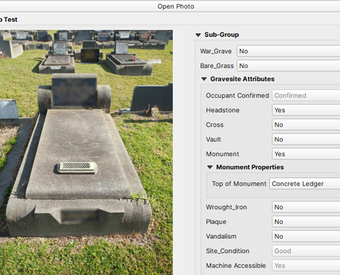
During the consultation phase, we evaluated the current state of the gravesite data and with the client, we discussed the specific attributes they needed. Together, we finalised a list of nearly 20 attributes to collect, including details like:
- A photo of the site
- Site condition
- Physical elements (headstone, plaque, etc.)
- Verification of whether the person(s) written on the grave matches FCC’s records.
Designing the QField Workspace
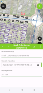
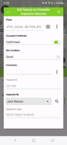
To tackle this project, we used QGIS and QField. QField is a free, open-source extension of QGIS that allows GIS workspaces to be used on a mobile device for data collection in the field. One of the most critical aspects of our setup was the attribute form, which needed to be as efficient as possible. We customised the form with checkboxes, dropdown lists, and default values, avoiding free text boxes wherever possible to streamline data entry.
The Data Collection Process
Before committing to the whole park, we conducted a pilot run on-site. Over a couple of days, we collected data and tested our QField setup, making note of potential improvements. We also shared these initial results with the client for feedback.One key finding from the pilot was that as much as we appreciated QField, it was faster and more comfortable to fill out many attribute values in bulk on a desktop computer. So, we adjusted our strategy. We modified the attribute form to focus on collecting only the information that had to be recorded in the field. The rest would be completed later using QGIS on PC, based on the photos taken on-site.Over the course of a week, our team dedicated time to photographing nearly 6,000 gravesites. The data collected in the field was then synchronised with the master QGIS document, where the remaining attributes were added.


