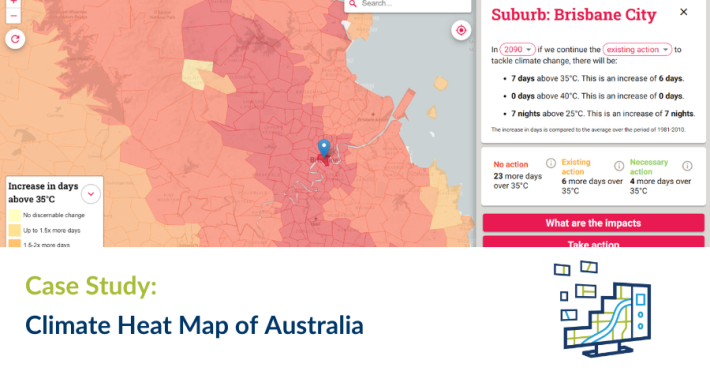
Common Ground brings together a wide range of government data, allowing resource titles to be viewed in context of National Parks, reserves, Strategic Agricultural Land, Native Title areas and indicative CSG residential exclusion zones. It provides both map-based and textual information on titles and companies and sets out the applications and approvals process for mineral, petroleum and gas projects in NSW, in plain language.
Spatial Vision designed a cloud-based architecture which integrated a number of “best of breed” cloud services for mapping and visualisation, feedback management, content management and analytics. Custom processes were developed to refresh the title data nightly from the department’s single source of truth.